You are here: Home > Network List > IU - Global Seismograph Network (GSN - IRIS/USGS) Stations List
> Station RSSD Black Hills, South Dakota, USA > Earthquake Result Viewer
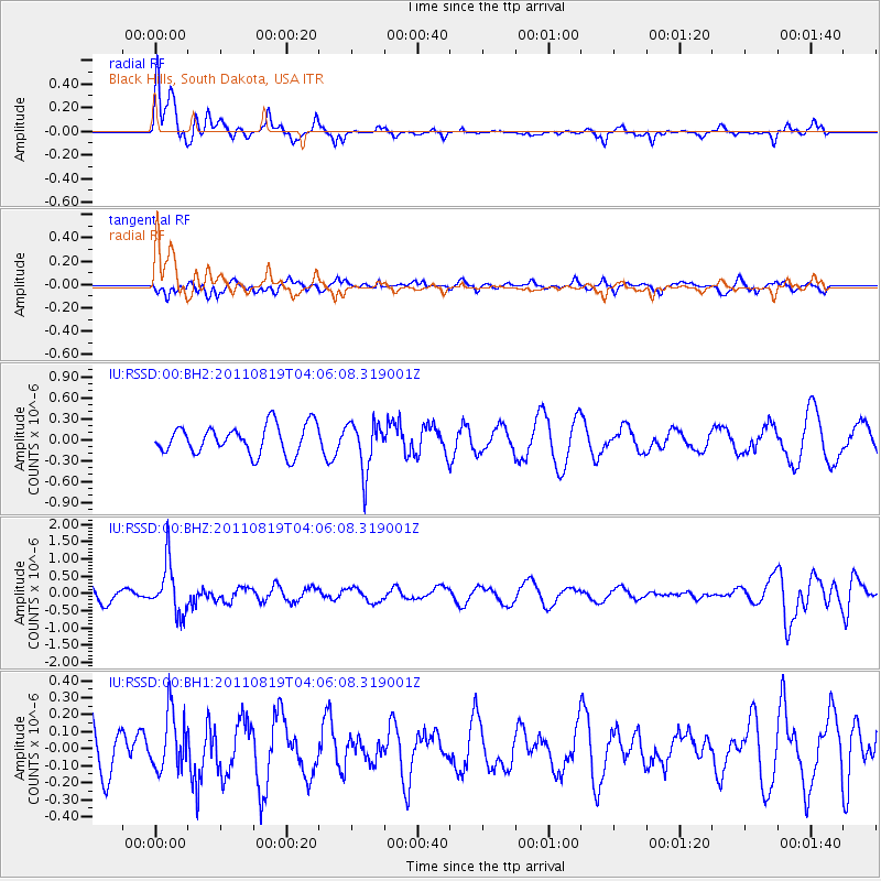
RSSD Black Hills, South Dakota, USA - Earthquake Result Viewer
*The percent match for this event was below the threshold and hence no stack was calculated.
| Earthquake location: |
Fiji Islands Region |
| Earthquake latitude/longitude: |
-16.5/-177.0 |
| Earthquake time(UTC): |
2011/08/19 (231) 03:54:26 GMT |
| Earthquake Depth: |
408 km |
| Earthquake Magnitude: |
5.5 MB, 6.2 MW, 6.2 MW |
| Earthquake Catalog/Contributor: |
WHDF/NEIC |
|
| Network: |
IU Global Seismograph Network (GSN - IRIS/USGS) |
| Station: |
RSSD Black Hills, South Dakota, USA |
| Lat/Lon: |
44.12 N/104.04 W |
| Elevation: |
2090 m |
|
| Distance: |
89.6 deg |
| Az: |
43.522 deg |
| Baz: |
246.517 deg |
| Ray Param: |
$rayparam |
*The percent match for this event was below the threshold and hence was not used in the summary stack. |
|
| Radial Match: |
77.400604 % |
| Radial Bump: |
361 |
| Transverse Match: |
49.77583 % |
| Transverse Bump: |
400 |
| SOD ConfigId: |
558545 |
| Insert Time: |
2013-09-19 01:16:19.735 +0000 |
| GWidth: |
2.5 |
| Max Bumps: |
400 |
| Tol: |
0.001 |
|
Signal To Noise
| Channel | StoN | STA | LTA |
| IU:RSSD:00:BHZ:20110819T04:06:08.319001Z | 3.1046062 | 7.3056515E-7 | 2.3531652E-7 |
| IU:RSSD:00:BH1:20110819T04:06:08.319001Z | 1.4084272 | 1.7100388E-7 | 1.2141477E-7 |
| IU:RSSD:00:BH2:20110819T04:06:08.319001Z | 1.7369182 | 3.5856232E-7 | 2.0643593E-7 |
| Arrivals |
| Ps | |
| PpPs | |
| PsPs/PpSs | |


