You are here: Home > Network List > US - United States National Seismic Network Stations List
> Station DGMT Dagmar, Montana, USA > Earthquake Result Viewer
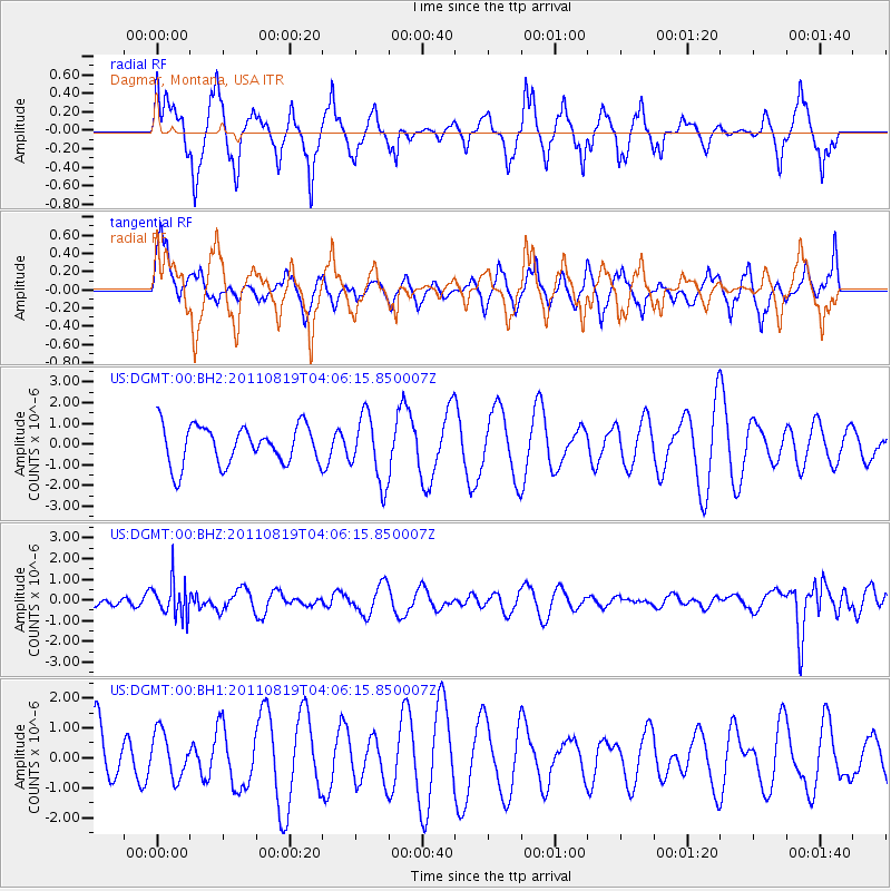
DGMT Dagmar, Montana, USA - Earthquake Result Viewer
*The percent match for this event was below the threshold and hence no stack was calculated.
| Earthquake location: |
Fiji Islands Region |
| Earthquake latitude/longitude: |
-16.5/-177.0 |
| Earthquake time(UTC): |
2011/08/19 (231) 03:54:26 GMT |
| Earthquake Depth: |
408 km |
| Earthquake Magnitude: |
5.5 MB, 6.2 MW, 6.2 MW |
| Earthquake Catalog/Contributor: |
WHDF/NEIC |
|
| Network: |
US United States National Seismic Network |
| Station: |
DGMT Dagmar, Montana, USA |
| Lat/Lon: |
48.47 N/104.20 W |
| Elevation: |
0.0 m |
|
| Distance: |
91.3 deg |
| Az: |
39.489 deg |
| Baz: |
246.434 deg |
| Ray Param: |
$rayparam |
*The percent match for this event was below the threshold and hence was not used in the summary stack. |
|
| Radial Match: |
78.3791 % |
| Radial Bump: |
396 |
| Transverse Match: |
51.866524 % |
| Transverse Bump: |
400 |
| SOD ConfigId: |
558545 |
| Insert Time: |
2013-09-19 01:16:46.898 +0000 |
| GWidth: |
2.5 |
| Max Bumps: |
400 |
| Tol: |
0.001 |
|
Signal To Noise
| Channel | StoN | STA | LTA |
| US:DGMT:00:BHZ:20110819T04:06:15.850007Z | 2.662909 | 8.395576E-7 | 3.1527836E-7 |
| US:DGMT:00:BH1:20110819T04:06:15.850007Z | 0.5335335 | 7.6342917E-7 | 1.4308928E-6 |
| US:DGMT:00:BH2:20110819T04:06:15.850007Z | 1.7119572 | 1.6048909E-6 | 9.374597E-7 |
| Arrivals |
| Ps | |
| PpPs | |
| PsPs/PpSs | |


