COR Corvallis, Oregon, USA - Earthquake Result Viewer
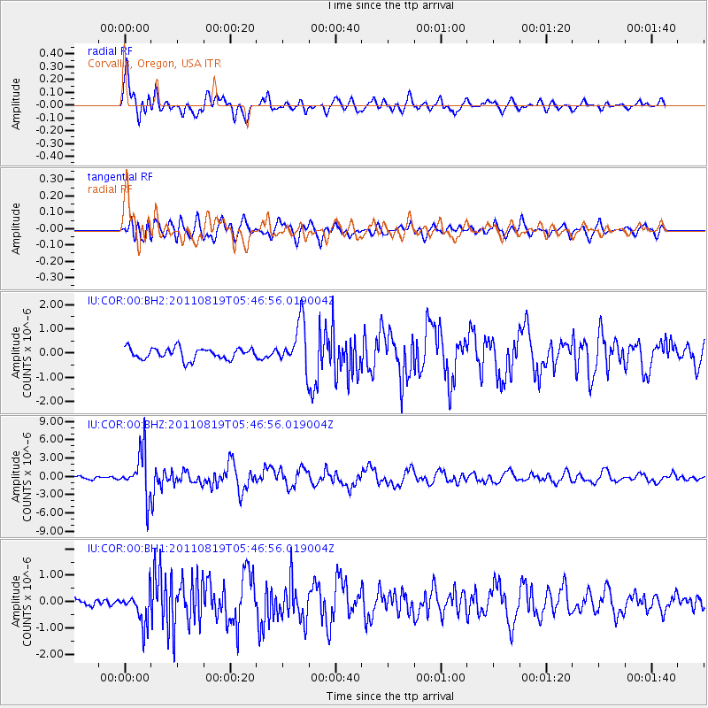
Earthquake location: Near East Coast Of Honshu, Japan
Earthquake latitude/longitude: 37.7/141.7
Earthquake time(UTC): 2011/08/19 (231) 05:36:33 GMT
Earthquake Depth: 47 km
Earthquake Magnitude: 6.3 MB, 5.9 MS, 6.3 MW, 6.3 MW
Earthquake Catalog/Contributor: WHDF/NEIC
Network: IU Global Seismograph Network (GSN - IRIS/USGS)
Station: COR Corvallis, Oregon, USA
Lat/Lon: 44.59 N/123.30 W
Elevation: 110 m
Distance: 67.9 deg
Az: 50.185 deg
Baz: 301.461 deg
Ray Param: 0.056549605
Estimated Moho Depth: 40.5 km
Estimated Crust Vp/Vs: 1.92
Assumed Crust Vp: 6.566 km/s
Estimated Crust Vs: 3.424 km/s
Estimated Crust Poisson's Ratio: 0.31
Radial Match: 88.814476 %
Radial Bump: 400
Transverse Match: 78.48816 %
Transverse Bump: 400
SOD ConfigId: 558545
Insert Time: 2013-09-19 01:18:52.880 +0000
GWidth: 2.5
Max Bumps: 400
Tol: 0.001

Signal To Noise

ChannelStoNSTALTA
IU:COR:00:BHZ:20110819T05:46:56.019004Z20.2986243.6738004E-61.8098767E-7
IU:COR:00:BH1:20110819T05:46:56.019004Z3.41694936.269318E-71.8347706E-7
IU:COR:00:BH2:20110819T05:46:56.019004Z4.13571029.621217E-72.326376E-7
Arrivals
Ps5.9 SECOND
PpPs17 SECOND
PsPs/PpSs23 SECOND