You are here: Home > Network List > US - United States National Seismic Network Stations List
> Station RLMT Red Lodge, Montana, USA > Earthquake Result Viewer
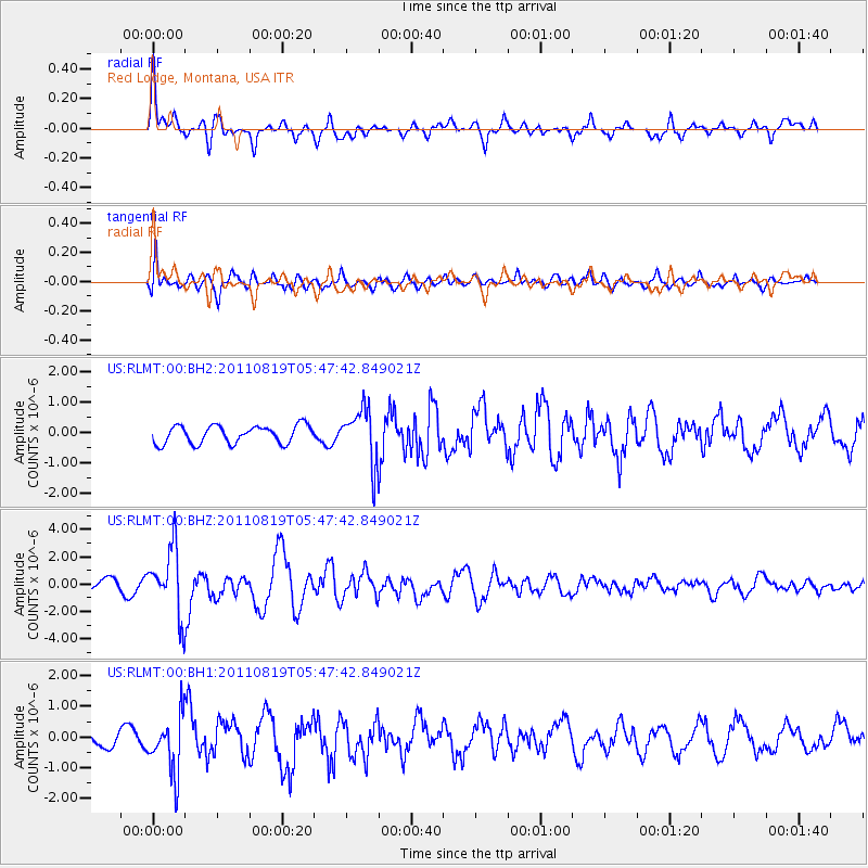
RLMT Red Lodge, Montana, USA - Earthquake Result Viewer
*The percent match for this event was below the threshold and hence no stack was calculated.
| Earthquake location: |
Near East Coast Of Honshu, Japan |
| Earthquake latitude/longitude: |
37.7/141.7 |
| Earthquake time(UTC): |
2011/08/19 (231) 05:36:33 GMT |
| Earthquake Depth: |
47 km |
| Earthquake Magnitude: |
6.3 MB, 5.9 MS, 6.3 MW, 6.3 MW |
| Earthquake Catalog/Contributor: |
WHDF/NEIC |
|
| Network: |
US United States National Seismic Network |
| Station: |
RLMT Red Lodge, Montana, USA |
| Lat/Lon: |
45.12 N/109.27 W |
| Elevation: |
2086 m |
|
| Distance: |
75.8 deg |
| Az: |
43.655 deg |
| Baz: |
309.311 deg |
| Ray Param: |
$rayparam |
*The percent match for this event was below the threshold and hence was not used in the summary stack. |
|
| Radial Match: |
65.31895 % |
| Radial Bump: |
400 |
| Transverse Match: |
76.9794 % |
| Transverse Bump: |
400 |
| SOD ConfigId: |
558545 |
| Insert Time: |
2013-09-19 01:21:48.763 +0000 |
| GWidth: |
2.5 |
| Max Bumps: |
400 |
| Tol: |
0.001 |
|
Signal To Noise
| Channel | StoN | STA | LTA |
| US:RLMT:00:BHZ:20110819T05:47:42.849021Z | 5.670739 | 2.4102424E-6 | 4.250314E-7 |
| US:RLMT:00:BH1:20110819T05:47:42.849021Z | 4.543779 | 9.4693763E-7 | 2.0840311E-7 |
| US:RLMT:00:BH2:20110819T05:47:42.849021Z | 2.9917235 | 8.764334E-7 | 2.9295268E-7 |
| Arrivals |
| Ps | |
| PpPs | |
| PsPs/PpSs | |


