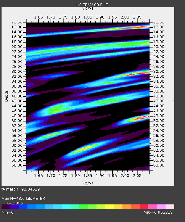
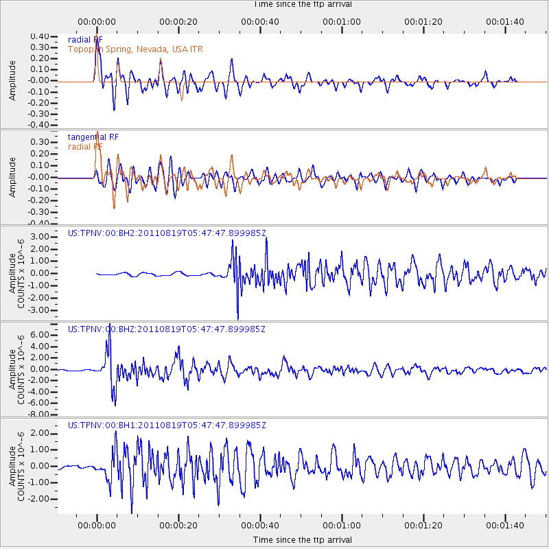
TPNV Topopah Spring, Nevada, USA - Earthquake Result Viewer

Earthquake location: Near East Coast Of Honshu, Japan
Earthquake latitude/longitude: 37.7/141.7
Earthquake time(UTC): 2011/08/19 (231) 05:36:33 GMT
Earthquake Depth: 47 km
Earthquake Magnitude: 6.3 MB, 5.9 MS, 6.3 MW, 6.3 MW
Earthquake Catalog/Contributor: WHDF/NEIC
Network: US United States National Seismic Network
Station: TPNV Topopah Spring, Nevada, USA
Lat/Lon: 36.95 N/116.25 W
Elevation: 1600 m
Distance: 76.6 deg
Az: 53.619 deg
Baz: 307.112 deg
Ray Param: 0.050772157
Estimated Moho Depth: 48.0 km
Estimated Crust Vp/Vs: 2.10
Assumed Crust Vp: 6.279 km/s
Estimated Crust Vs: 2.997 km/s
Estimated Crust Poisson's Ratio: 0.35
Radial Match: 90.04629 %
Radial Bump: 400
Transverse Match: 86.85633 %
Transverse Bump: 400
SOD ConfigId: 558545
Insert Time: 2013-09-19 01:21:53.639 +0000
GWidth: 2.5
Max Bumps: 400
Tol: 0.001

Signal To Noise

ChannelStoNSTALTA
US:TPNV:00:BHZ:20110819T05:47:47.899985Z35.0274433.2217026E-69.1976524E-8
US:TPNV:00:BH1:20110819T05:47:47.899985Z6.8518418.4536094E-71.2337719E-7
US:TPNV:00:BH2:20110819T05:47:47.899985Z10.044061.1648075E-61.1596978E-7
Arrivals
Ps8.6 SECOND
PpPs23 SECOND
PsPs/PpSs32 SECOND