You are here: Home > Network List > IU - Global Seismograph Network (GSN - IRIS/USGS) Stations List
> Station MAJO Matsushiro, Japan > Earthquake Result Viewer
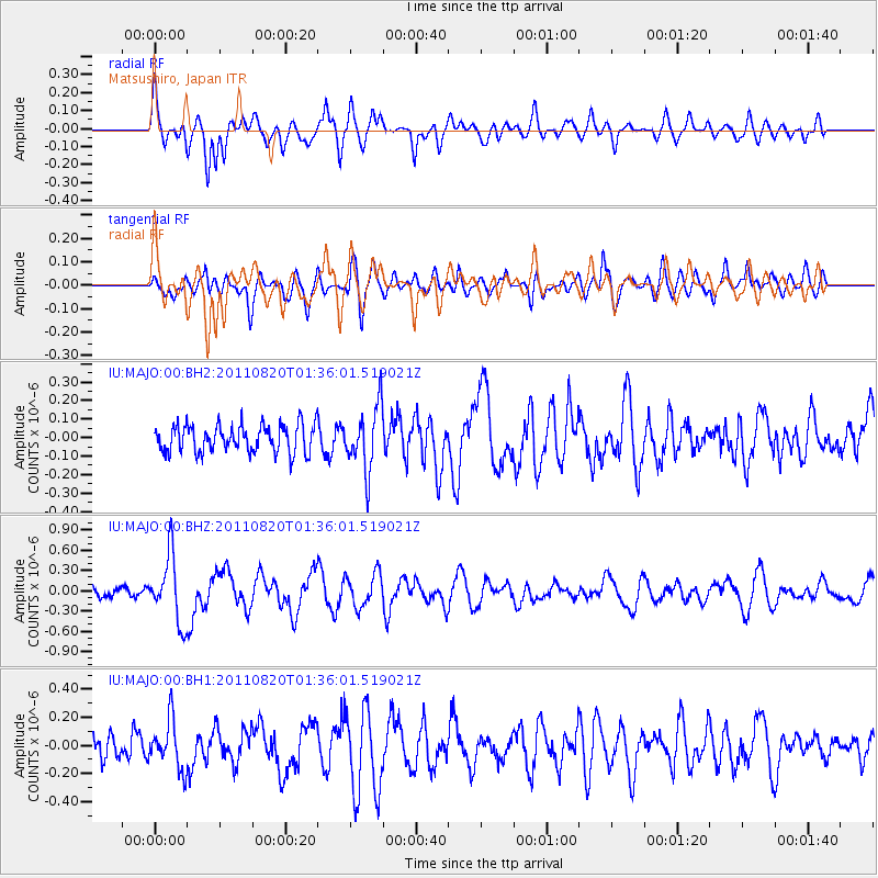
MAJO Matsushiro, Japan - Earthquake Result Viewer
*The percent match for this event was below the threshold and hence no stack was calculated.
| Earthquake location: |
Tonga Islands Region |
| Earthquake latitude/longitude: |
-22.5/-174.9 |
| Earthquake time(UTC): |
2011/08/20 (232) 01:24:59 GMT |
| Earthquake Depth: |
10 km |
| Earthquake Magnitude: |
5.6 MW, 5.5 MS |
| Earthquake Catalog/Contributor: |
NEIC PDE/NEIC PDE-M |
|
| Network: |
IU Global Seismograph Network (GSN - IRIS/USGS) |
| Station: |
MAJO Matsushiro, Japan |
| Lat/Lon: |
36.55 N/138.20 E |
| Elevation: |
405 m |
|
| Distance: |
73.5 deg |
| Az: |
322.215 deg |
| Baz: |
135.284 deg |
| Ray Param: |
$rayparam |
*The percent match for this event was below the threshold and hence was not used in the summary stack. |
|
| Radial Match: |
70.7836 % |
| Radial Bump: |
400 |
| Transverse Match: |
70.74003 % |
| Transverse Bump: |
400 |
| SOD ConfigId: |
558545 |
| Insert Time: |
2013-09-19 01:22:57.003 +0000 |
| GWidth: |
2.5 |
| Max Bumps: |
400 |
| Tol: |
0.001 |
|
Signal To Noise
| Channel | StoN | STA | LTA |
| IU:MAJO:00:BHZ:20110820T01:36:01.519021Z | 4.936623 | 4.9199986E-7 | 9.966325E-8 |
| IU:MAJO:00:BH1:20110820T01:36:01.519021Z | 2.343868 | 1.7383917E-7 | 7.4167644E-8 |
| IU:MAJO:00:BH2:20110820T01:36:01.519021Z | 2.3344905 | 1.7265248E-7 | 7.395724E-8 |
| Arrivals |
| Ps | |
| PpPs | |
| PsPs/PpSs | |


