You are here: Home > Network List > IU - Global Seismograph Network (GSN - IRIS/USGS) Stations List
> Station PMG Port Moresby, New Guinea > Earthquake Result Viewer
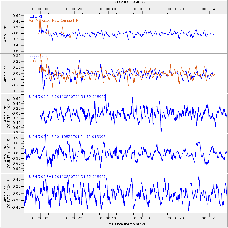
PMG Port Moresby, New Guinea - Earthquake Result Viewer
*The percent match for this event was below the threshold and hence no stack was calculated.
| Earthquake location: |
Tonga Islands Region |
| Earthquake latitude/longitude: |
-22.5/-174.9 |
| Earthquake time(UTC): |
2011/08/20 (232) 01:24:59 GMT |
| Earthquake Depth: |
10 km |
| Earthquake Magnitude: |
5.6 MW, 5.5 MS |
| Earthquake Catalog/Contributor: |
NEIC PDE/NEIC PDE-M |
|
| Network: |
IU Global Seismograph Network (GSN - IRIS/USGS) |
| Station: |
PMG Port Moresby, New Guinea |
| Lat/Lon: |
9.40 S/147.16 E |
| Elevation: |
90 m |
|
| Distance: |
38.6 deg |
| Az: |
283.562 deg |
| Baz: |
114.348 deg |
| Ray Param: |
$rayparam |
*The percent match for this event was below the threshold and hence was not used in the summary stack. |
|
| Radial Match: |
62.699215 % |
| Radial Bump: |
400 |
| Transverse Match: |
62.326443 % |
| Transverse Bump: |
400 |
| SOD ConfigId: |
558545 |
| Insert Time: |
2013-09-19 01:23:08.721 +0000 |
| GWidth: |
2.5 |
| Max Bumps: |
400 |
| Tol: |
0.001 |
|
Signal To Noise
| Channel | StoN | STA | LTA |
| IU:PMG:00:BHZ:20110820T01:31:52.01899Z | 3.5169582 | 4.3654657E-7 | 1.2412617E-7 |
| IU:PMG:00:BH1:20110820T01:31:52.01899Z | 1.6700907 | 2.0657546E-7 | 1.2369117E-7 |
| IU:PMG:00:BH2:20110820T01:31:52.01899Z | 1.4668753 | 2.53927E-7 | 1.7310742E-7 |
| Arrivals |
| Ps | |
| PpPs | |
| PsPs/PpSs | |


