You are here: Home > Network List > US - United States National Seismic Network Stations List
> Station AMTX Amarillo, Texas, USA > Earthquake Result Viewer
AMTX Amarillo, Texas, USA - Earthquake Result Viewer
*The percent match for this event was below the threshold and hence no stack was calculated.
| Earthquake location: |
Tonga Islands Region |
| Earthquake latitude/longitude: |
-22.5/-174.9 |
| Earthquake time(UTC): |
2011/08/20 (232) 01:24:59 GMT |
| Earthquake Depth: |
10 km |
| Earthquake Magnitude: |
5.6 MW, 5.5 MS |
| Earthquake Catalog/Contributor: |
NEIC PDE/NEIC PDE-M |
|
| Network: |
US United States National Seismic Network |
| Station: |
AMTX Amarillo, Texas, USA |
| Lat/Lon: |
34.53 N/101.41 W |
| Elevation: |
1010 m |
|
| Distance: |
89.9 deg |
| Az: |
52.349 deg |
| Baz: |
242.479 deg |
| Ray Param: |
$rayparam |
*The percent match for this event was below the threshold and hence was not used in the summary stack. |
|
| Radial Match: |
70.84258 % |
| Radial Bump: |
400 |
| Transverse Match: |
50.30428 % |
| Transverse Bump: |
400 |
| SOD ConfigId: |
558545 |
| Insert Time: |
2013-09-19 01:23:25.258 +0000 |
| GWidth: |
2.5 |
| Max Bumps: |
400 |
| Tol: |
0.001 |
|
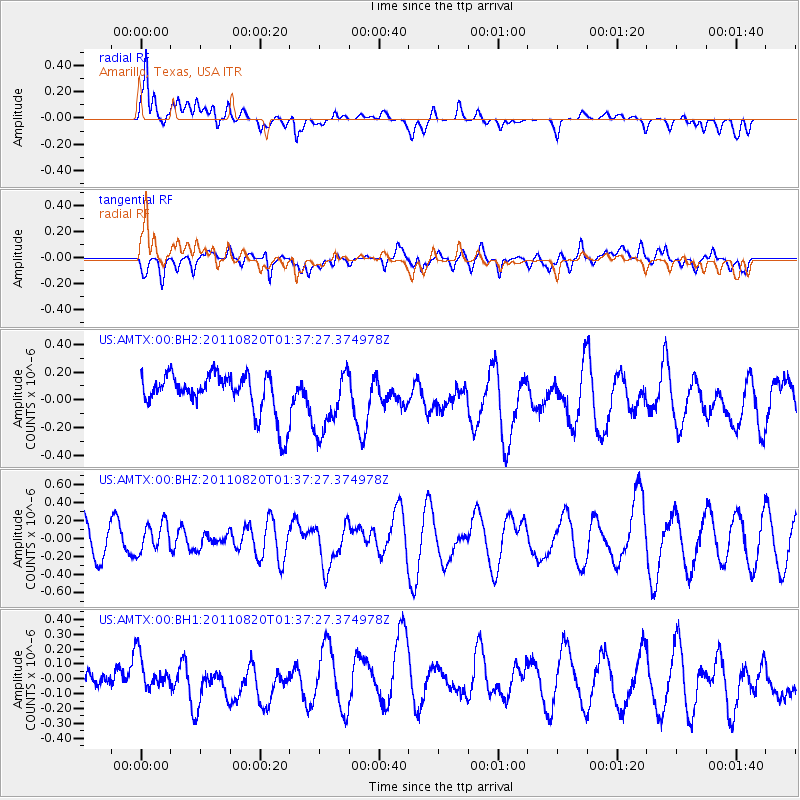
Signal To Noise
| Channel | StoN | STA | LTA |
| US:AMTX:00:BHZ:20110820T01:37:27.374978Z | 1.0991592 | 1.569701E-7 | 1.4280924E-7 |
| US:AMTX:00:BH1:20110820T01:37:27.374978Z | 1.0204829 | 1.1753134E-7 | 1.15172284E-7 |
| US:AMTX:00:BH2:20110820T01:37:27.374978Z | 1.5157943 | 2.2498715E-7 | 1.4842854E-7 |
| Arrivals |
| Ps | |
| PpPs | |
| PsPs/PpSs | |


