You are here: Home > Network List > US - United States National Seismic Network Stations List
> Station NATX Nacogdoches, Texas, USA > Earthquake Result Viewer
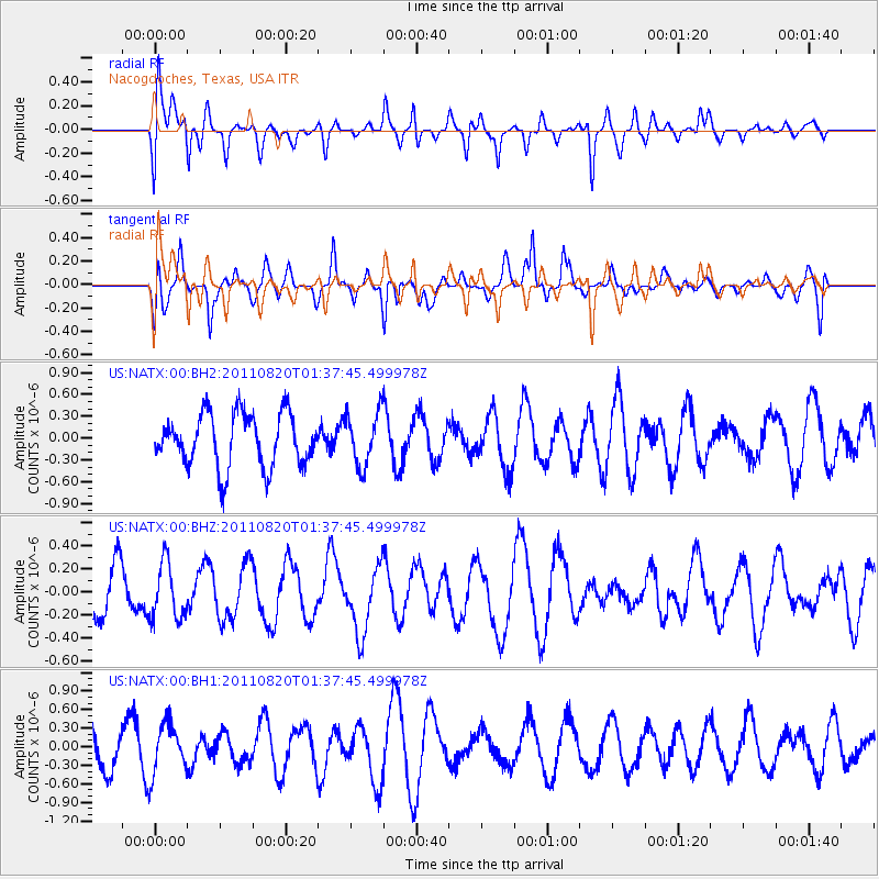
NATX Nacogdoches, Texas, USA - Earthquake Result Viewer
*The percent match for this event was below the threshold and hence no stack was calculated.
| Earthquake location: |
Tonga Islands Region |
| Earthquake latitude/longitude: |
-22.5/-174.9 |
| Earthquake time(UTC): |
2011/08/20 (232) 01:24:59 GMT |
| Earthquake Depth: |
10 km |
| Earthquake Magnitude: |
5.6 MW, 5.5 MS |
| Earthquake Catalog/Contributor: |
NEIC PDE/NEIC PDE-M |
|
| Network: |
US United States National Seismic Network |
| Station: |
NATX Nacogdoches, Texas, USA |
| Lat/Lon: |
31.76 N/94.66 W |
| Elevation: |
156 m |
|
| Distance: |
93.8 deg |
| Az: |
57.296 deg |
| Baz: |
245.994 deg |
| Ray Param: |
$rayparam |
*The percent match for this event was below the threshold and hence was not used in the summary stack. |
|
| Radial Match: |
59.048485 % |
| Radial Bump: |
364 |
| Transverse Match: |
58.53405 % |
| Transverse Bump: |
400 |
| SOD ConfigId: |
558545 |
| Insert Time: |
2013-09-19 01:23:52.497 +0000 |
| GWidth: |
2.5 |
| Max Bumps: |
400 |
| Tol: |
0.001 |
|
Signal To Noise
| Channel | StoN | STA | LTA |
| US:NATX:00:BHZ:20110820T01:37:45.499978Z | 0.9506423 | 2.448574E-7 | 2.575705E-7 |
| US:NATX:00:BH1:20110820T01:37:45.499978Z | 1.3668946 | 4.1035116E-7 | 3.0020686E-7 |
| US:NATX:00:BH2:20110820T01:37:45.499978Z | 1.0140427 | 3.6786153E-7 | 3.627673E-7 |
| Arrivals |
| Ps | |
| PpPs | |
| PsPs/PpSs | |


