You are here: Home > Network List > US - United States National Seismic Network Stations List
> Station HAWA Hanford, Washington, USA > Earthquake Result Viewer
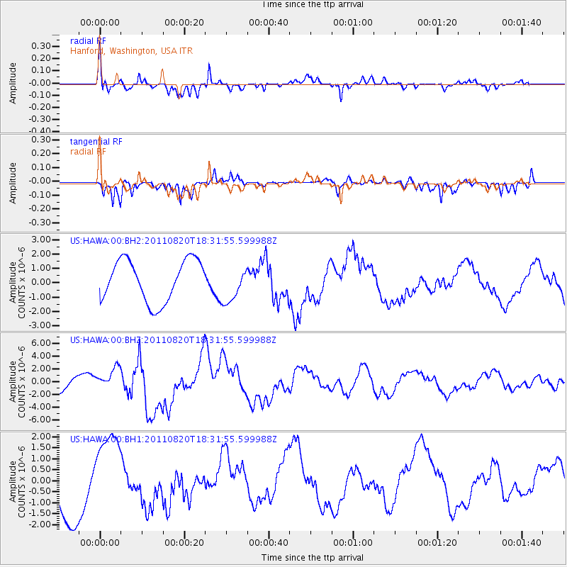
HAWA Hanford, Washington, USA - Earthquake Result Viewer
*The percent match for this event was below the threshold and hence no stack was calculated.
| Earthquake location: |
Vanuatu Islands |
| Earthquake latitude/longitude: |
-18.3/168.2 |
| Earthquake time(UTC): |
2011/08/20 (232) 18:19:23 GMT |
| Earthquake Depth: |
28 km |
| Earthquake Magnitude: |
6.4 MB, 7.1 MS, 7.1 MW, 7.0 MW |
| Earthquake Catalog/Contributor: |
WHDF/NEIC |
|
| Network: |
US United States National Seismic Network |
| Station: |
HAWA Hanford, Washington, USA |
| Lat/Lon: |
46.39 N/119.53 W |
| Elevation: |
364 m |
|
| Distance: |
91.4 deg |
| Az: |
41.254 deg |
| Baz: |
244.829 deg |
| Ray Param: |
$rayparam |
*The percent match for this event was below the threshold and hence was not used in the summary stack. |
|
| Radial Match: |
78.8339 % |
| Radial Bump: |
376 |
| Transverse Match: |
55.752644 % |
| Transverse Bump: |
350 |
| SOD ConfigId: |
558545 |
| Insert Time: |
2013-09-19 01:30:27.030 +0000 |
| GWidth: |
2.5 |
| Max Bumps: |
400 |
| Tol: |
0.001 |
|
Signal To Noise
| Channel | StoN | STA | LTA |
| US:HAWA:00:BHZ:20110820T18:31:55.599988Z | 0.988799 | 1.9554163E-6 | 1.977567E-6 |
| US:HAWA:00:BH1:20110820T18:31:55.599988Z | 1.407201 | 1.9789588E-6 | 1.4063086E-6 |
| US:HAWA:00:BH2:20110820T18:31:55.599988Z | 0.85324067 | 1.2269596E-6 | 1.4379996E-6 |
| Arrivals |
| Ps | |
| PpPs | |
| PsPs/PpSs | |


