You are here: Home > Network List > CN - Canadian National Seismograph Network Stations List
> Station INK INUVIK, NT, CANADA.ANADA > Earthquake Result Viewer
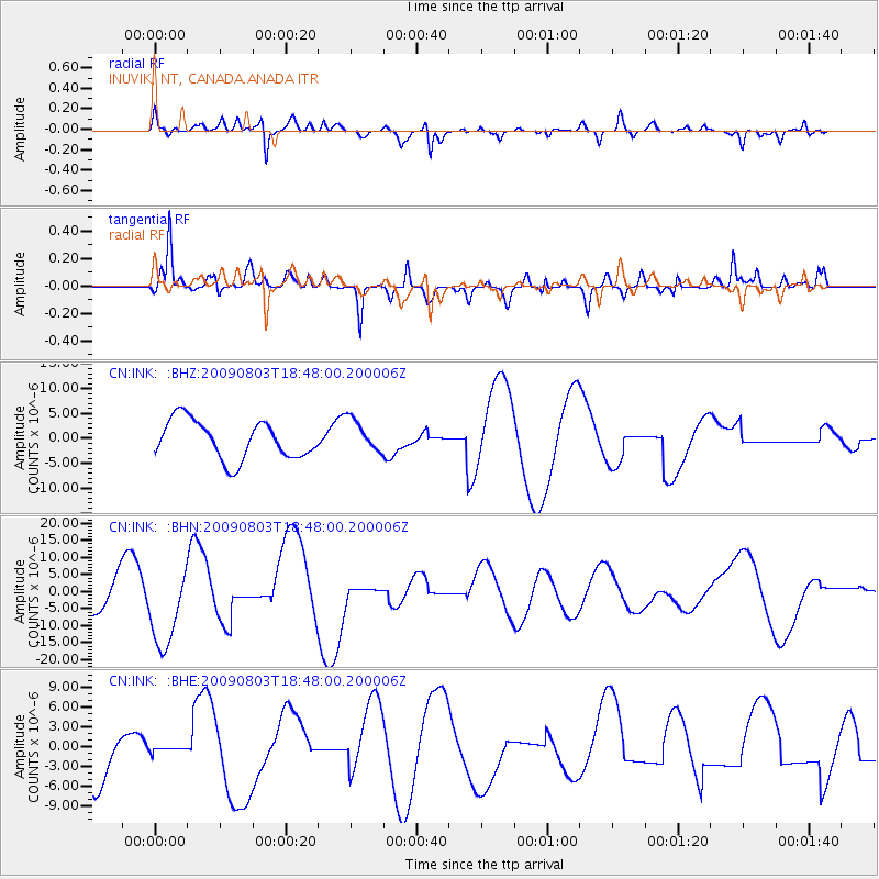
INK INUVIK, NT, CANADA.ANADA - Earthquake Result Viewer
*The percent match for this event was below the threshold and hence no stack was calculated.
| Earthquake location: |
Gulf Of California |
| Earthquake latitude/longitude: |
29.3/-113.7 |
| Earthquake time(UTC): |
2009/08/03 (215) 18:40:50 GMT |
| Earthquake Depth: |
10 km |
| Earthquake Magnitude: |
5.9 MB, 6.2 MW |
| Earthquake Catalog/Contributor: |
WHDF/NEIC |
|
| Network: |
CN Canadian National Seismograph Network |
| Station: |
INK INUVIK, NT, CANADA.ANADA |
| Lat/Lon: |
68.31 N/133.52 W |
| Elevation: |
40 m |
|
| Distance: |
40.7 deg |
| Az: |
348.879 deg |
| Baz: |
153.056 deg |
| Ray Param: |
$rayparam |
*The percent match for this event was below the threshold and hence was not used in the summary stack. |
|
| Radial Match: |
66.87423 % |
| Radial Bump: |
400 |
| Transverse Match: |
74.04952 % |
| Transverse Bump: |
400 |
| SOD ConfigId: |
2622 |
| Insert Time: |
2010-02-27 06:20:50.658 +0000 |
| GWidth: |
2.5 |
| Max Bumps: |
400 |
| Tol: |
0.001 |
|
Signal To Noise
| Channel | StoN | STA | LTA |
| CN:INK: :BHN:20090803T18:48:00.200006Z | 3.1338842 | 1.1695032E-5 | 3.7318011E-6 |
| CN:INK: :BHE:20090803T18:48:00.200006Z | 0.07553658 | 3.6902242E-7 | 4.885347E-6 |
| CN:INK: :BHZ:20090803T18:48:00.200006Z | 0.8674117 | 3.3503586E-6 | 3.862478E-6 |
| Arrivals |
| Ps | |
| PpPs | |
| PsPs/PpSs | |


