You are here: Home > Network List > CN - Canadian National Seismograph Network Stations List
> Station INK INUVIK, NT, CANADA.ANADA > Earthquake Result Viewer
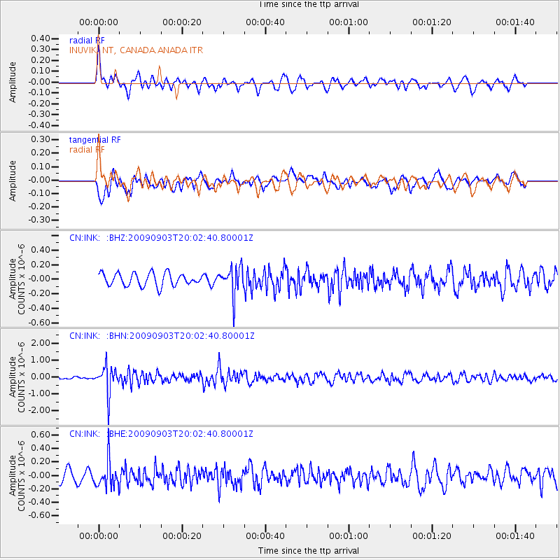
INK INUVIK, NT, CANADA.ANADA - Earthquake Result Viewer
*The percent match for this event was below the threshold and hence no stack was calculated.
| Earthquake location: |
Myanmar-India Border Region |
| Earthquake latitude/longitude: |
24.3/94.7 |
| Earthquake time(UTC): |
2009/09/03 (246) 19:51:08 GMT |
| Earthquake Depth: |
105 km |
| Earthquake Magnitude: |
5.7 MB, 5.9 MW, 5.8 MW |
| Earthquake Catalog/Contributor: |
WHDF/NEIC |
|
| Network: |
CN Canadian National Seismograph Network |
| Station: |
INK INUVIK, NT, CANADA.ANADA |
| Lat/Lon: |
68.31 N/133.52 W |
| Elevation: |
40 m |
|
| Distance: |
81.1 deg |
| Az: |
16.292 deg |
| Baz: |
316.502 deg |
| Ray Param: |
$rayparam |
*The percent match for this event was below the threshold and hence was not used in the summary stack. |
|
| Radial Match: |
72.6181 % |
| Radial Bump: |
389 |
| Transverse Match: |
64.13387 % |
| Transverse Bump: |
400 |
| SOD ConfigId: |
2622 |
| Insert Time: |
2010-02-27 06:21:00.588 +0000 |
| GWidth: |
2.5 |
| Max Bumps: |
400 |
| Tol: |
0.001 |
|
Signal To Noise
| Channel | StoN | STA | LTA |
| CN:INK: :BHN:20090903T20:02:40.80001Z | 10.411684 | 8.2772374E-7 | 7.949951E-8 |
| CN:INK: :BHE:20090903T20:02:40.80001Z | 2.2433074 | 2.0500693E-7 | 9.138602E-8 |
| CN:INK: :BHZ:20090903T20:02:40.80001Z | 2.2699668 | 1.9631821E-7 | 8.648506E-8 |
| Arrivals |
| Ps | |
| PpPs | |
| PsPs/PpSs | |


