You are here: Home > Network List > CN - Canadian National Seismograph Network Stations List
> Station INK INUVIK, NT, CANADA.ANADA > Earthquake Result Viewer
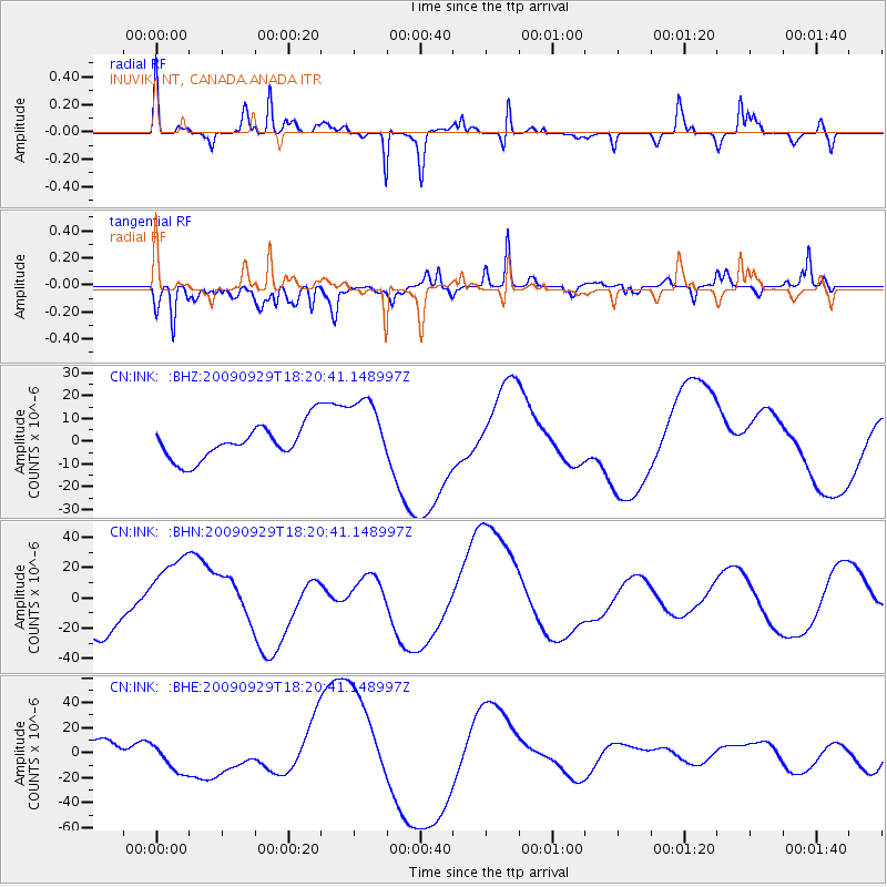
INK INUVIK, NT, CANADA.ANADA - Earthquake Result Viewer
*The percent match for this event was below the threshold and hence no stack was calculated.
| Earthquake location: |
Samoa Islands Region |
| Earthquake latitude/longitude: |
-15.6/-172.0 |
| Earthquake time(UTC): |
2009/09/29 (272) 18:08:21 GMT |
| Earthquake Depth: |
10 km |
| Earthquake Magnitude: |
5.6 MB |
| Earthquake Catalog/Contributor: |
WHDF/NEIC |
|
| Network: |
CN Canadian National Seismograph Network |
| Station: |
INK INUVIK, NT, CANADA.ANADA |
| Lat/Lon: |
68.31 N/133.52 W |
| Elevation: |
40 m |
|
| Distance: |
88.1 deg |
| Az: |
13.388 deg |
| Baz: |
216.888 deg |
| Ray Param: |
$rayparam |
*The percent match for this event was below the threshold and hence was not used in the summary stack. |
|
| Radial Match: |
55.49258 % |
| Radial Bump: |
296 |
| Transverse Match: |
66.68124 % |
| Transverse Bump: |
400 |
| SOD ConfigId: |
2622 |
| Insert Time: |
2010-02-27 06:21:09.458 +0000 |
| GWidth: |
2.5 |
| Max Bumps: |
400 |
| Tol: |
0.001 |
|
Signal To Noise
| Channel | StoN | STA | LTA |
| CN:INK: :BHN:20090929T18:20:41.148997Z | 1.8724431 | 2.5212497E-5 | 1.3465028E-5 |
| CN:INK: :BHE:20090929T18:20:41.148997Z | 1.1894298 | 1.298947E-5 | 1.0920755E-5 |
| CN:INK: :BHZ:20090929T18:20:41.148997Z | 2.1082668 | 1.591099E-5 | 7.5469525E-6 |
| Arrivals |
| Ps | |
| PpPs | |
| PsPs/PpSs | |


