You are here: Home > Network List > US - United States National Seismic Network Stations List
> Station MSO Missoula, Montana, USA > Earthquake Result Viewer
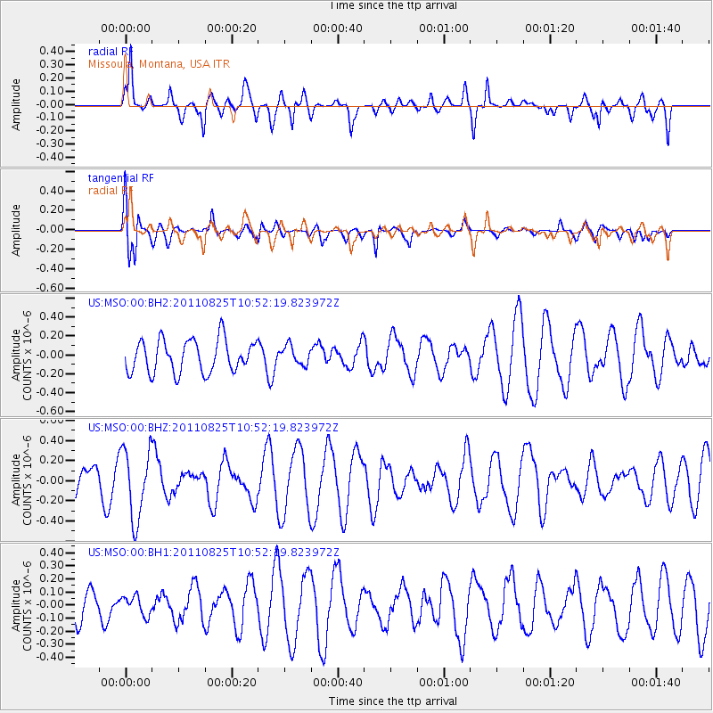
MSO Missoula, Montana, USA - Earthquake Result Viewer
*The percent match for this event was below the threshold and hence no stack was calculated.
| Earthquake location: |
Vanuatu Islands |
| Earthquake latitude/longitude: |
-13.6/167.0 |
| Earthquake time(UTC): |
2011/08/25 (237) 10:39:58 GMT |
| Earthquake Depth: |
159 km |
| Earthquake Magnitude: |
5.6 MB, 5.9 MW, 5.9 MW |
| Earthquake Catalog/Contributor: |
WHDF/NEIC |
|
| Network: |
US United States National Seismic Network |
| Station: |
MSO Missoula, Montana, USA |
| Lat/Lon: |
46.83 N/113.94 W |
| Elevation: |
1264 m |
|
| Distance: |
92.5 deg |
| Az: |
42.437 deg |
| Baz: |
252.855 deg |
| Ray Param: |
$rayparam |
*The percent match for this event was below the threshold and hence was not used in the summary stack. |
|
| Radial Match: |
64.65788 % |
| Radial Bump: |
400 |
| Transverse Match: |
64.56168 % |
| Transverse Bump: |
400 |
| SOD ConfigId: |
558545 |
| Insert Time: |
2013-09-19 01:52:28.597 +0000 |
| GWidth: |
2.5 |
| Max Bumps: |
400 |
| Tol: |
0.001 |
|
Signal To Noise
| Channel | StoN | STA | LTA |
| US:MSO:00:BHZ:20110825T10:52:19.823972Z | 1.792398 | 3.4916994E-7 | 1.9480603E-7 |
| US:MSO:00:BH1:20110825T10:52:19.823972Z | 0.55873245 | 7.379963E-8 | 1.3208404E-7 |
| US:MSO:00:BH2:20110825T10:52:19.823972Z | 0.5707563 | 9.897783E-8 | 1.7341522E-7 |
| Arrivals |
| Ps | |
| PpPs | |
| PsPs/PpSs | |


