You are here: Home > Network List > US - United States National Seismic Network Stations List
> Station LKWY Lake (Yellowstone--Lake), Wyoming, USA > Earthquake Result Viewer
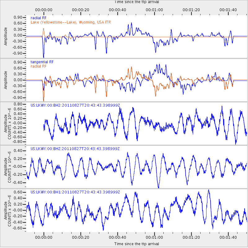
LKWY Lake (Yellowstone--Lake), Wyoming, USA - Earthquake Result Viewer
*The percent match for this event was below the threshold and hence no stack was calculated.
| Earthquake location: |
South Of Fiji Islands |
| Earthquake latitude/longitude: |
-24.6/179.9 |
| Earthquake time(UTC): |
2011/08/27 (239) 20:31:53 GMT |
| Earthquake Depth: |
509 km |
| Earthquake Magnitude: |
5.7 MW, 5.1 MB |
| Earthquake Catalog/Contributor: |
WHDF/NEIC |
|
| Network: |
US United States National Seismic Network |
| Station: |
LKWY Lake (Yellowstone--Lake), Wyoming, USA |
| Lat/Lon: |
44.57 N/110.40 W |
| Elevation: |
2424 m |
|
| Distance: |
93.6 deg |
| Az: |
42.195 deg |
| Baz: |
238.802 deg |
| Ray Param: |
$rayparam |
*The percent match for this event was below the threshold and hence was not used in the summary stack. |
|
| Radial Match: |
58.87055 % |
| Radial Bump: |
400 |
| Transverse Match: |
38.554886 % |
| Transverse Bump: |
400 |
| SOD ConfigId: |
558545 |
| Insert Time: |
2013-09-19 01:55:16.135 +0000 |
| GWidth: |
2.5 |
| Max Bumps: |
400 |
| Tol: |
0.001 |
|
Signal To Noise
| Channel | StoN | STA | LTA |
| US:LKWY:00:BHZ:20110827T20:43:43.398999Z | 0.8498987 | 1.11717405E-7 | 1.3144792E-7 |
| US:LKWY:00:BH1:20110827T20:43:43.398999Z | 1.2590048 | 2.801632E-7 | 2.2252749E-7 |
| US:LKWY:00:BH2:20110827T20:43:43.398999Z | 0.56058544 | 1.4765045E-7 | 2.6338617E-7 |
| Arrivals |
| Ps | |
| PpPs | |
| PsPs/PpSs | |


