You are here: Home > Network List > US - United States National Seismic Network Stations List
> Station WUAZ Wupatki, Arizona, USA > Earthquake Result Viewer
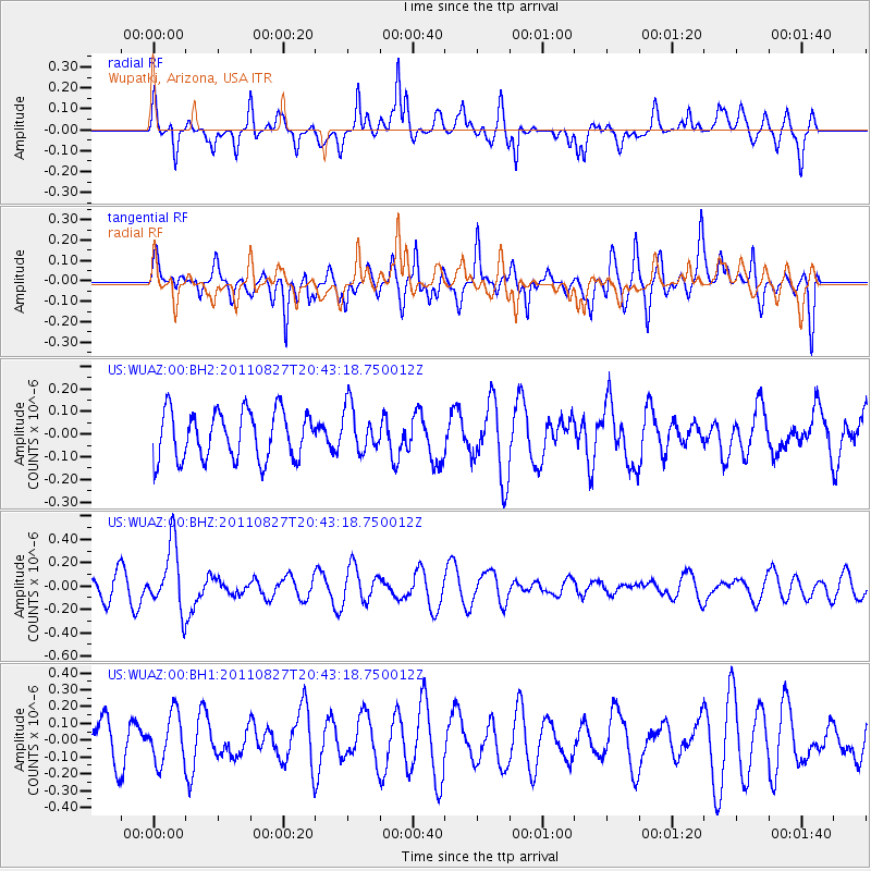
WUAZ Wupatki, Arizona, USA - Earthquake Result Viewer
*The percent match for this event was below the threshold and hence no stack was calculated.
| Earthquake location: |
South Of Fiji Islands |
| Earthquake latitude/longitude: |
-24.6/179.9 |
| Earthquake time(UTC): |
2011/08/27 (239) 20:31:53 GMT |
| Earthquake Depth: |
509 km |
| Earthquake Magnitude: |
5.7 MW, 5.1 MB |
| Earthquake Catalog/Contributor: |
WHDF/NEIC |
|
| Network: |
US United States National Seismic Network |
| Station: |
WUAZ Wupatki, Arizona, USA |
| Lat/Lon: |
35.52 N/111.37 W |
| Elevation: |
1592 m |
|
| Distance: |
88.3 deg |
| Az: |
49.501 deg |
| Baz: |
238.055 deg |
| Ray Param: |
$rayparam |
*The percent match for this event was below the threshold and hence was not used in the summary stack. |
|
| Radial Match: |
56.80159 % |
| Radial Bump: |
390 |
| Transverse Match: |
54.11431 % |
| Transverse Bump: |
400 |
| SOD ConfigId: |
558545 |
| Insert Time: |
2013-09-19 01:55:30.847 +0000 |
| GWidth: |
2.5 |
| Max Bumps: |
400 |
| Tol: |
0.001 |
|
Signal To Noise
| Channel | StoN | STA | LTA |
| US:WUAZ:00:BHZ:20110827T20:43:18.750012Z | 2.335359 | 2.8085046E-7 | 1.2026008E-7 |
| US:WUAZ:00:BH1:20110827T20:43:18.750012Z | 1.2585367 | 1.4569592E-7 | 1.1576613E-7 |
| US:WUAZ:00:BH2:20110827T20:43:18.750012Z | 0.9545932 | 1.0121129E-7 | 1.0602558E-7 |
| Arrivals |
| Ps | |
| PpPs | |
| PsPs/PpSs | |


