You are here: Home > Network List > US - United States National Seismic Network Stations List
> Station MIAR Mount Ida, Arkansas, USA > Earthquake Result Viewer
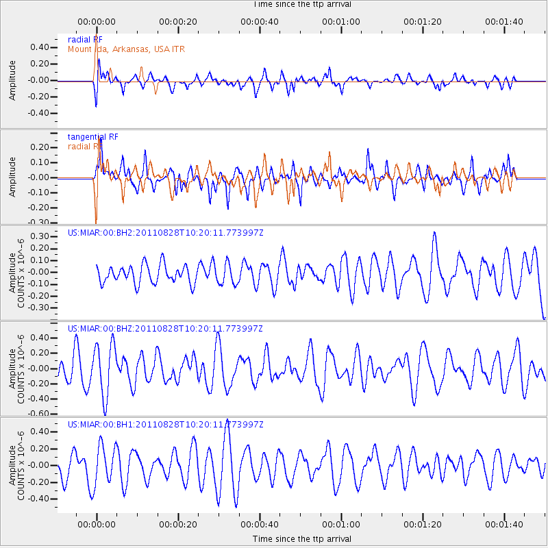
MIAR Mount Ida, Arkansas, USA - Earthquake Result Viewer
*The percent match for this event was below the threshold and hence no stack was calculated.
| Earthquake location: |
Southern East Pacific Rise |
| Earthquake latitude/longitude: |
-24.5/-115.9 |
| Earthquake time(UTC): |
2011/08/28 (240) 10:10:19 GMT |
| Earthquake Depth: |
10 km |
| Earthquake Magnitude: |
5.6 MW |
| Earthquake Catalog/Contributor: |
NEIC PDE/NEIC PDE-M |
|
| Network: |
US United States National Seismic Network |
| Station: |
MIAR Mount Ida, Arkansas, USA |
| Lat/Lon: |
34.55 N/93.58 W |
| Elevation: |
207 m |
|
| Distance: |
62.5 deg |
| Az: |
20.746 deg |
| Baz: |
203.006 deg |
| Ray Param: |
$rayparam |
*The percent match for this event was below the threshold and hence was not used in the summary stack. |
|
| Radial Match: |
42.0098 % |
| Radial Bump: |
400 |
| Transverse Match: |
67.844345 % |
| Transverse Bump: |
400 |
| SOD ConfigId: |
558545 |
| Insert Time: |
2013-09-19 01:57:43.520 +0000 |
| GWidth: |
2.5 |
| Max Bumps: |
400 |
| Tol: |
0.001 |
|
Signal To Noise
| Channel | StoN | STA | LTA |
| US:MIAR:00:BHZ:20110828T10:20:11.773997Z | 2.4511142 | 3.4974482E-7 | 1.426881E-7 |
| US:MIAR:00:BH1:20110828T10:20:11.773997Z | 1.4727494 | 2.2782896E-7 | 1.5469635E-7 |
| US:MIAR:00:BH2:20110828T10:20:11.773997Z | 1.1267735 | 8.445997E-8 | 7.495736E-8 |
| Arrivals |
| Ps | |
| PpPs | |
| PsPs/PpSs | |


