You are here: Home > Network List > II - Global Seismograph Network (GSN - IRIS/IDA) Stations List
> Station WRAB Tennant Creek, NT, Australia > Earthquake Result Viewer
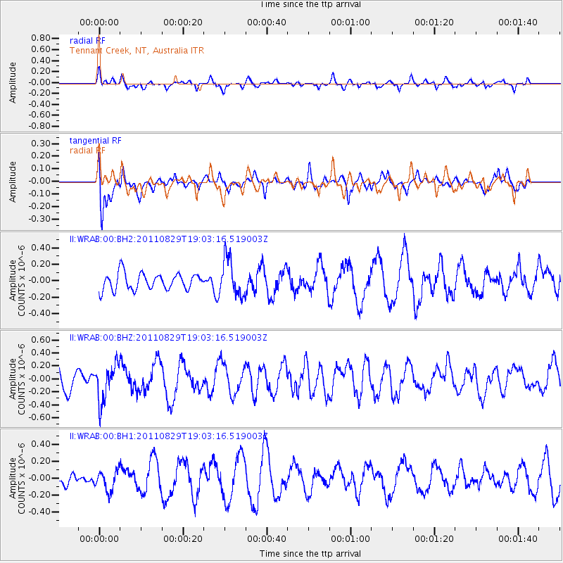
WRAB Tennant Creek, NT, Australia - Earthquake Result Viewer
*The percent match for this event was below the threshold and hence no stack was calculated.
| Earthquake location: |
Vanuatu Islands |
| Earthquake latitude/longitude: |
-16.4/167.9 |
| Earthquake time(UTC): |
2011/08/29 (241) 18:57:39 GMT |
| Earthquake Depth: |
202 km |
| Earthquake Magnitude: |
5.5 MB, 5.6 MW |
| Earthquake Catalog/Contributor: |
WHDF/NEIC |
|
| Network: |
II Global Seismograph Network (GSN - IRIS/IDA) |
| Station: |
WRAB Tennant Creek, NT, Australia |
| Lat/Lon: |
19.93 S/134.36 E |
| Elevation: |
366 m |
|
| Distance: |
32.1 deg |
| Az: |
258.476 deg |
| Baz: |
89.152 deg |
| Ray Param: |
$rayparam |
*The percent match for this event was below the threshold and hence was not used in the summary stack. |
|
| Radial Match: |
59.809834 % |
| Radial Bump: |
395 |
| Transverse Match: |
60.628223 % |
| Transverse Bump: |
400 |
| SOD ConfigId: |
558545 |
| Insert Time: |
2013-09-19 01:58:35.256 +0000 |
| GWidth: |
2.5 |
| Max Bumps: |
400 |
| Tol: |
0.001 |
|
Signal To Noise
| Channel | StoN | STA | LTA |
| II:WRAB:00:BHZ:20110829T19:03:16.519003Z | 1.0152416 | 2.9368468E-7 | 2.8927565E-7 |
| II:WRAB:00:BH1:20110829T19:03:16.519003Z | 0.88759667 | 1.2508951E-7 | 1.4093058E-7 |
| II:WRAB:00:BH2:20110829T19:03:16.519003Z | 2.2900596 | 2.3130045E-7 | 1.0100194E-7 |
| Arrivals |
| Ps | |
| PpPs | |
| PsPs/PpSs | |


