You are here: Home > Network List > IU - Global Seismograph Network (GSN - IRIS/USGS) Stations List
> Station JOHN Johnston Island, USA > Earthquake Result Viewer
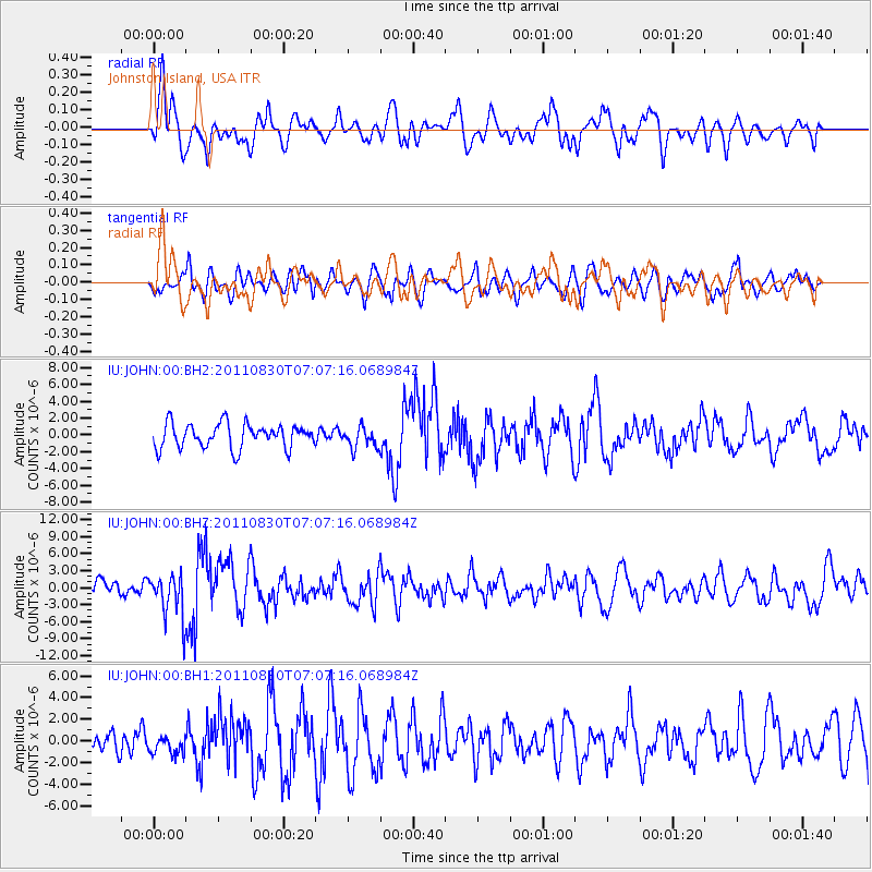
JOHN Johnston Island, USA - Earthquake Result Viewer
*The percent match for this event was below the threshold and hence no stack was calculated.
| Earthquake location: |
Banda Sea |
| Earthquake latitude/longitude: |
-6.4/126.8 |
| Earthquake time(UTC): |
2011/08/30 (242) 06:57:41 GMT |
| Earthquake Depth: |
470 km |
| Earthquake Magnitude: |
6.0 MB, 6.9 MW, 6.9 MW |
| Earthquake Catalog/Contributor: |
WHDF/NEIC |
|
| Network: |
IU Global Seismograph Network (GSN - IRIS/USGS) |
| Station: |
JOHN Johnston Island, USA |
| Lat/Lon: |
16.73 N/169.53 W |
| Elevation: |
2.0 m |
|
| Distance: |
67.0 deg |
| Az: |
68.924 deg |
| Baz: |
255.444 deg |
| Ray Param: |
$rayparam |
*The percent match for this event was below the threshold and hence was not used in the summary stack. |
|
| Radial Match: |
55.063198 % |
| Radial Bump: |
400 |
| Transverse Match: |
45.785034 % |
| Transverse Bump: |
400 |
| SOD ConfigId: |
558545 |
| Insert Time: |
2013-09-19 02:00:32.753 +0000 |
| GWidth: |
2.5 |
| Max Bumps: |
400 |
| Tol: |
0.001 |
|
Signal To Noise
| Channel | StoN | STA | LTA |
| IU:JOHN:00:BHZ:20110830T07:07:16.068984Z | 2.7464204 | 3.8050334E-6 | 1.3854519E-6 |
| IU:JOHN:00:BH1:20110830T07:07:16.068984Z | 0.712766 | 8.543174E-7 | 1.1985945E-6 |
| IU:JOHN:00:BH2:20110830T07:07:16.068984Z | 0.8711538 | 1.2457774E-6 | 1.4300316E-6 |
| Arrivals |
| Ps | |
| PpPs | |
| PsPs/PpSs | |


