You are here: Home > Network List > IU - Global Seismograph Network (GSN - IRIS/USGS) Stations List
> Station RSSD Black Hills, South Dakota, USA > Earthquake Result Viewer
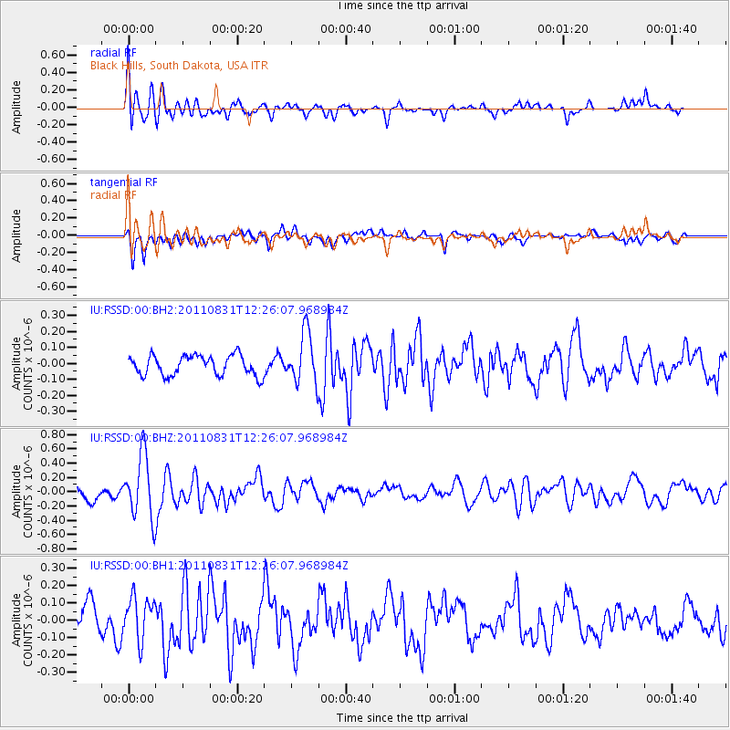
RSSD Black Hills, South Dakota, USA - Earthquake Result Viewer
*The percent match for this event was below the threshold and hence no stack was calculated.
| Earthquake location: |
Northern Mid-Atlantic Ridge |
| Earthquake latitude/longitude: |
43.6/-28.9 |
| Earthquake time(UTC): |
2011/08/31 (243) 12:17:27 GMT |
| Earthquake Depth: |
10 km |
| Earthquake Magnitude: |
5.6 MW, 5.5 MW |
| Earthquake Catalog/Contributor: |
NEIC PDE/NEIC PDE-M |
|
| Network: |
IU Global Seismograph Network (GSN - IRIS/USGS) |
| Station: |
RSSD Black Hills, South Dakota, USA |
| Lat/Lon: |
44.12 N/104.04 W |
| Elevation: |
2090 m |
|
| Distance: |
52.3 deg |
| Az: |
298.449 deg |
| Baz: |
62.507 deg |
| Ray Param: |
$rayparam |
*The percent match for this event was below the threshold and hence was not used in the summary stack. |
|
| Radial Match: |
71.81977 % |
| Radial Bump: |
400 |
| Transverse Match: |
66.8789 % |
| Transverse Bump: |
400 |
| SOD ConfigId: |
558545 |
| Insert Time: |
2013-09-19 02:04:00.497 +0000 |
| GWidth: |
2.5 |
| Max Bumps: |
400 |
| Tol: |
0.001 |
|
Signal To Noise
| Channel | StoN | STA | LTA |
| IU:RSSD:00:BHZ:20110831T12:26:07.968984Z | 5.3131385 | 4.461091E-7 | 8.396339E-8 |
| IU:RSSD:00:BH1:20110831T12:26:07.968984Z | 1.336267 | 1.2366951E-7 | 9.2548504E-8 |
| IU:RSSD:00:BH2:20110831T12:26:07.968984Z | 2.5679615 | 1.6186495E-7 | 6.3032466E-8 |
| Arrivals |
| Ps | |
| PpPs | |
| PsPs/PpSs | |


