You are here: Home > Network List > US - United States National Seismic Network Stations List
> Station COWI Conover, Wisconsin, USA > Earthquake Result Viewer
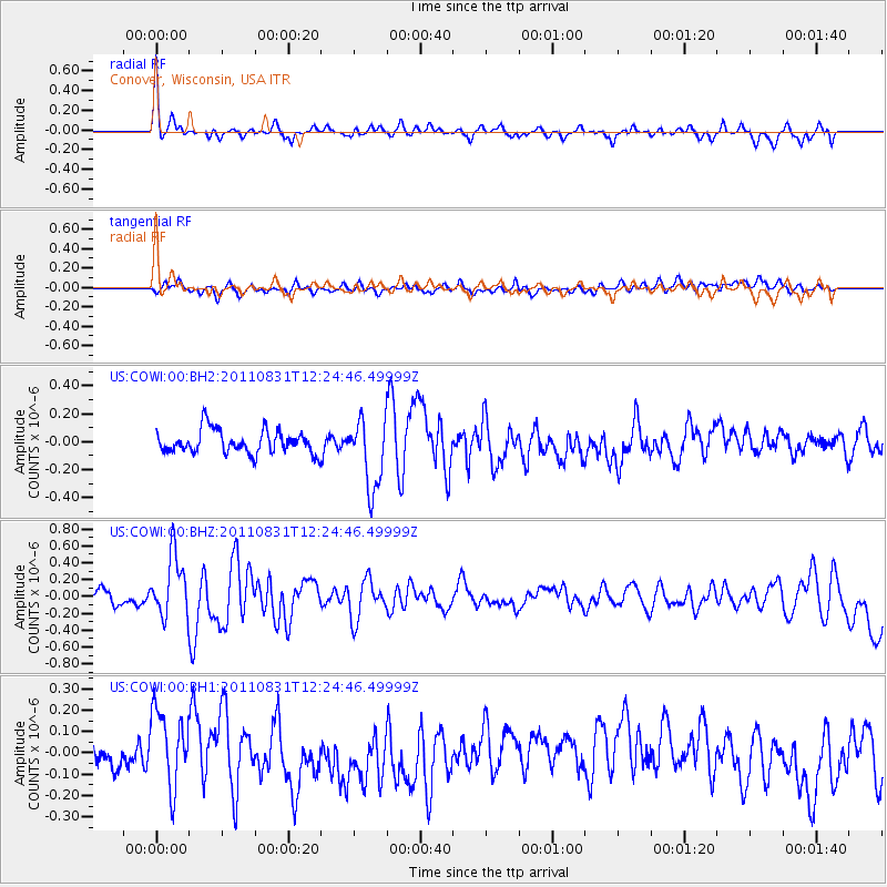
COWI Conover, Wisconsin, USA - Earthquake Result Viewer
*The percent match for this event was below the threshold and hence no stack was calculated.
| Earthquake location: |
Northern Mid-Atlantic Ridge |
| Earthquake latitude/longitude: |
43.6/-28.9 |
| Earthquake time(UTC): |
2011/08/31 (243) 12:17:27 GMT |
| Earthquake Depth: |
10 km |
| Earthquake Magnitude: |
5.6 MW, 5.5 MW |
| Earthquake Catalog/Contributor: |
NEIC PDE/NEIC PDE-M |
|
| Network: |
US United States National Seismic Network |
| Station: |
COWI Conover, Wisconsin, USA |
| Lat/Lon: |
46.10 N/89.14 W |
| Elevation: |
523 m |
|
| Distance: |
41.9 deg |
| Az: |
295.224 deg |
| Baz: |
70.855 deg |
| Ray Param: |
$rayparam |
*The percent match for this event was below the threshold and hence was not used in the summary stack. |
|
| Radial Match: |
74.35723 % |
| Radial Bump: |
400 |
| Transverse Match: |
53.59964 % |
| Transverse Bump: |
400 |
| SOD ConfigId: |
558545 |
| Insert Time: |
2013-09-19 02:04:52.646 +0000 |
| GWidth: |
2.5 |
| Max Bumps: |
400 |
| Tol: |
0.001 |
|
Signal To Noise
| Channel | StoN | STA | LTA |
| US:COWI:00:BHZ:20110831T12:24:46.49999Z | 3.22358 | 3.6442188E-7 | 1.1304881E-7 |
| US:COWI:00:BH1:20110831T12:24:46.49999Z | 2.8323195 | 1.7925402E-7 | 6.3288766E-8 |
| US:COWI:00:BH2:20110831T12:24:46.49999Z | 3.0029354 | 2.506305E-7 | 8.3461835E-8 |
| Arrivals |
| Ps | |
| PpPs | |
| PsPs/PpSs | |


