You are here: Home > Network List > US - United States National Seismic Network Stations List
> Station DGMT Dagmar, Montana, USA > Earthquake Result Viewer
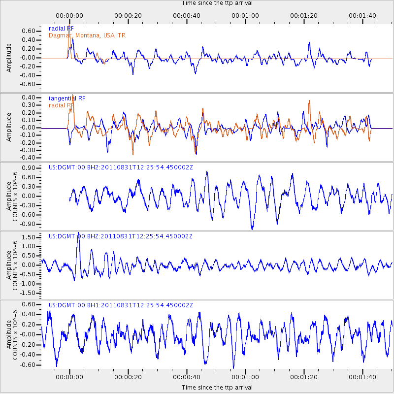
DGMT Dagmar, Montana, USA - Earthquake Result Viewer
*The percent match for this event was below the threshold and hence no stack was calculated.
| Earthquake location: |
Northern Mid-Atlantic Ridge |
| Earthquake latitude/longitude: |
43.6/-28.9 |
| Earthquake time(UTC): |
2011/08/31 (243) 12:17:27 GMT |
| Earthquake Depth: |
10 km |
| Earthquake Magnitude: |
5.6 MW, 5.5 MW |
| Earthquake Catalog/Contributor: |
NEIC PDE/NEIC PDE-M |
|
| Network: |
US United States National Seismic Network |
| Station: |
DGMT Dagmar, Montana, USA |
| Lat/Lon: |
48.47 N/104.20 W |
| Elevation: |
0.0 m |
|
| Distance: |
50.5 deg |
| Az: |
303.513 deg |
| Baz: |
65.55 deg |
| Ray Param: |
$rayparam |
*The percent match for this event was below the threshold and hence was not used in the summary stack. |
|
| Radial Match: |
57.98819 % |
| Radial Bump: |
400 |
| Transverse Match: |
53.955112 % |
| Transverse Bump: |
296 |
| SOD ConfigId: |
558545 |
| Insert Time: |
2013-09-19 02:04:55.483 +0000 |
| GWidth: |
2.5 |
| Max Bumps: |
400 |
| Tol: |
0.001 |
|
Signal To Noise
| Channel | StoN | STA | LTA |
| US:DGMT:00:BHZ:20110831T12:25:54.450002Z | 3.7767391 | 7.168044E-7 | 1.8979452E-7 |
| US:DGMT:00:BH1:20110831T12:25:54.450002Z | 0.9239782 | 2.508089E-7 | 2.7144463E-7 |
| US:DGMT:00:BH2:20110831T12:25:54.450002Z | 1.0435495 | 2.4147184E-7 | 2.3139471E-7 |
| Arrivals |
| Ps | |
| PpPs | |
| PsPs/PpSs | |


