You are here: Home > Network List > US - United States National Seismic Network Stations List
> Station EGMT Eagleton, Montana, USA > Earthquake Result Viewer
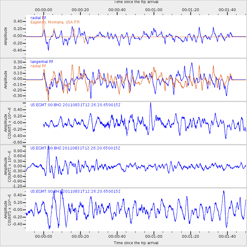
EGMT Eagleton, Montana, USA - Earthquake Result Viewer
*The percent match for this event was below the threshold and hence no stack was calculated.
| Earthquake location: |
Northern Mid-Atlantic Ridge |
| Earthquake latitude/longitude: |
43.6/-28.9 |
| Earthquake time(UTC): |
2011/08/31 (243) 12:17:27 GMT |
| Earthquake Depth: |
10 km |
| Earthquake Magnitude: |
5.6 MW, 5.5 MW |
| Earthquake Catalog/Contributor: |
NEIC PDE/NEIC PDE-M |
|
| Network: |
US United States National Seismic Network |
| Station: |
EGMT Eagleton, Montana, USA |
| Lat/Lon: |
48.02 N/109.75 W |
| Elevation: |
1055 m |
|
| Distance: |
54.1 deg |
| Az: |
305.067 deg |
| Baz: |
62.365 deg |
| Ray Param: |
$rayparam |
*The percent match for this event was below the threshold and hence was not used in the summary stack. |
|
| Radial Match: |
73.48955 % |
| Radial Bump: |
400 |
| Transverse Match: |
59.12716 % |
| Transverse Bump: |
400 |
| SOD ConfigId: |
558545 |
| Insert Time: |
2013-09-19 02:05:06.515 +0000 |
| GWidth: |
2.5 |
| Max Bumps: |
400 |
| Tol: |
0.001 |
|
Signal To Noise
| Channel | StoN | STA | LTA |
| US:EGMT:00:BHZ:20110831T12:26:20.650015Z | 5.852602 | 4.8230606E-7 | 8.2408825E-8 |
| US:EGMT:00:BH1:20110831T12:26:20.650015Z | 2.118768 | 2.5077918E-7 | 1.1836085E-7 |
| US:EGMT:00:BH2:20110831T12:26:20.650015Z | 1.2249463 | 9.681586E-8 | 7.903682E-8 |
| Arrivals |
| Ps | |
| PpPs | |
| PsPs/PpSs | |


