You are here: Home > Network List > US - United States National Seismic Network Stations List
> Station HAWA Hanford, Washington, USA > Earthquake Result Viewer
HAWA Hanford, Washington, USA - Earthquake Result Viewer
*The percent match for this event was below the threshold and hence no stack was calculated.
| Earthquake location: |
Northern Mid-Atlantic Ridge |
| Earthquake latitude/longitude: |
43.6/-28.9 |
| Earthquake time(UTC): |
2011/08/31 (243) 12:17:27 GMT |
| Earthquake Depth: |
10 km |
| Earthquake Magnitude: |
5.6 MW, 5.5 MW |
| Earthquake Catalog/Contributor: |
NEIC PDE/NEIC PDE-M |
|
| Network: |
US United States National Seismic Network |
| Station: |
HAWA Hanford, Washington, USA |
| Lat/Lon: |
46.39 N/119.53 W |
| Elevation: |
364 m |
|
| Distance: |
60.6 deg |
| Az: |
307.428 deg |
| Baz: |
56.478 deg |
| Ray Param: |
$rayparam |
*The percent match for this event was below the threshold and hence was not used in the summary stack. |
|
| Radial Match: |
66.51942 % |
| Radial Bump: |
400 |
| Transverse Match: |
69.34587 % |
| Transverse Bump: |
400 |
| SOD ConfigId: |
558545 |
| Insert Time: |
2013-09-19 02:05:16.026 +0000 |
| GWidth: |
2.5 |
| Max Bumps: |
400 |
| Tol: |
0.001 |
|
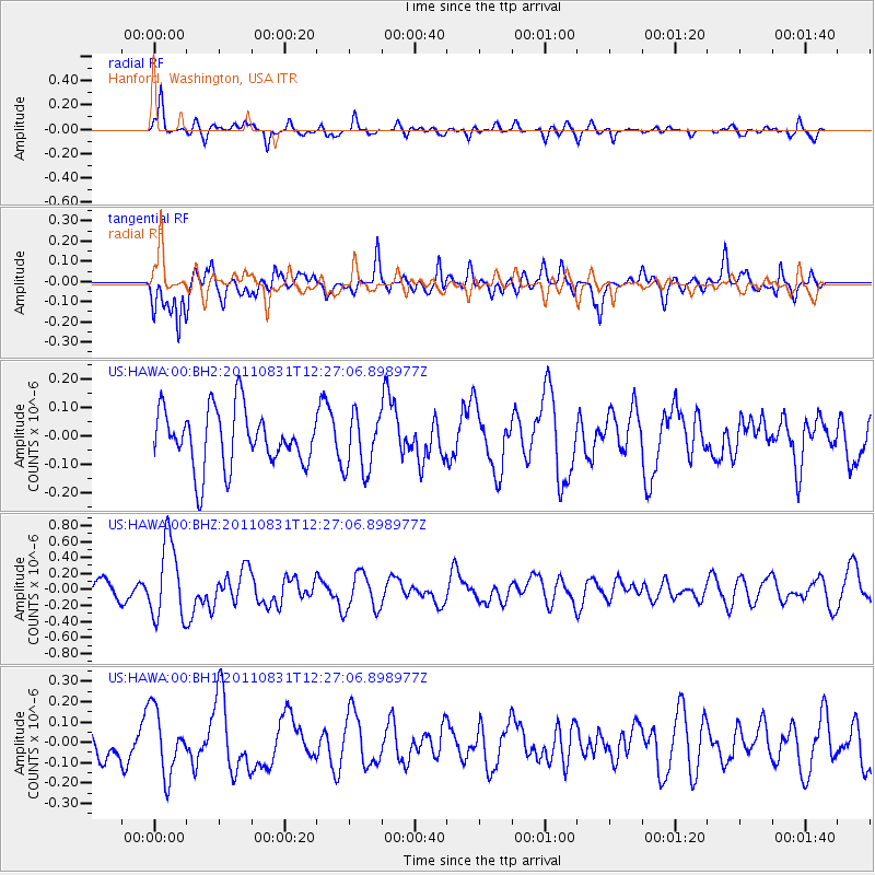
Signal To Noise
| Channel | StoN | STA | LTA |
| US:HAWA:00:BHZ:20110831T12:27:06.898977Z | 3.5037735 | 4.841771E-7 | 1.3818733E-7 |
| US:HAWA:00:BH1:20110831T12:27:06.898977Z | 1.4732755 | 1.5787778E-7 | 1.07161064E-7 |
| US:HAWA:00:BH2:20110831T12:27:06.898977Z | 1.0002358 | 1.0053759E-7 | 1.00513894E-7 |
| Arrivals |
| Ps | |
| PpPs | |
| PsPs/PpSs | |


