You are here: Home > Network List > CN - Canadian National Seismograph Network Stations List
> Station INK INUVIK, NT, CANADA.ANADA > Earthquake Result Viewer
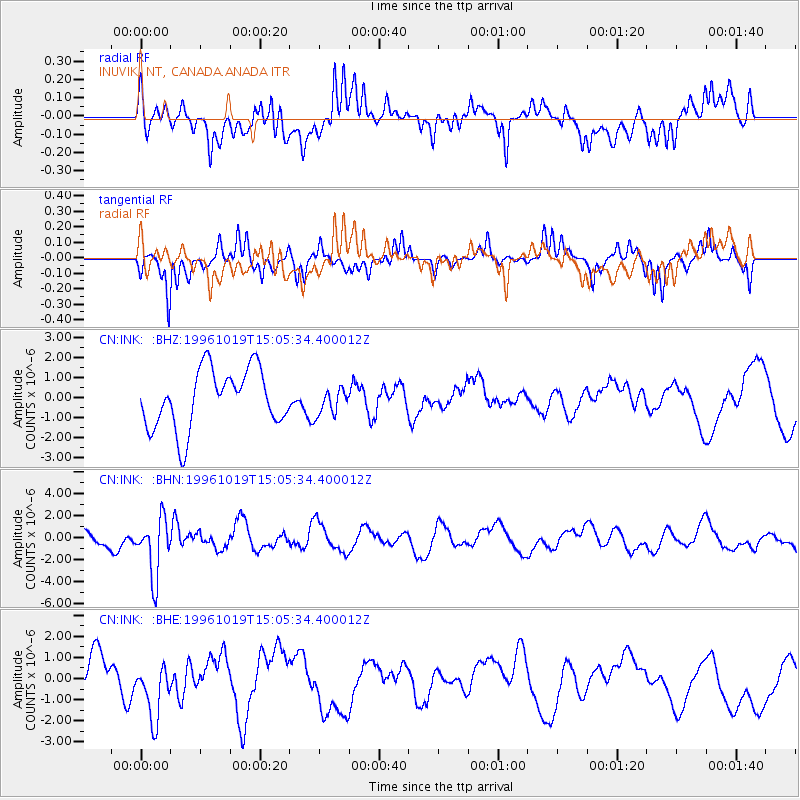
INK INUVIK, NT, CANADA.ANADA - Earthquake Result Viewer
*The percent match for this event was below the threshold and hence no stack was calculated.
| Earthquake location: |
Fiji Islands Region |
| Earthquake latitude/longitude: |
-20.4/-178.5 |
| Earthquake time(UTC): |
1996/10/19 (293) 14:53:48 GMT |
| Earthquake Depth: |
591 km |
| Earthquake Magnitude: |
6.1 MB, 6.9 UNKNOWN, 6.8 MW |
| Earthquake Catalog/Contributor: |
WHDF/NEIC |
|
| Network: |
CN Canadian National Seismograph Network |
| Station: |
INK INUVIK, NT, CANADA.ANADA |
| Lat/Lon: |
68.31 N/133.52 W |
| Elevation: |
40 m |
|
| Distance: |
94.3 deg |
| Az: |
15.283 deg |
| Baz: |
221.683 deg |
| Ray Param: |
$rayparam |
*The percent match for this event was below the threshold and hence was not used in the summary stack. |
|
| Radial Match: |
56.13067 % |
| Radial Bump: |
400 |
| Transverse Match: |
58.694782 % |
| Transverse Bump: |
287 |
| SOD ConfigId: |
4480 |
| Insert Time: |
2010-02-27 06:21:34.713 +0000 |
| GWidth: |
2.5 |
| Max Bumps: |
400 |
| Tol: |
0.001 |
|
Signal To Noise
| Channel | StoN | STA | LTA |
| CN:INK: :BHN:19961019T15:05:34.400012Z | 3.2522106 | 2.6539124E-6 | 8.160334E-7 |
| CN:INK: :BHE:19961019T15:05:34.400012Z | 1.2004732 | 1.374968E-6 | 1.145355E-6 |
| CN:INK: :BHZ:19961019T15:05:34.400012Z | 0.43524683 | 6.3439364E-7 | 1.4575492E-6 |
| Arrivals |
| Ps | |
| PpPs | |
| PsPs/PpSs | |


