You are here: Home > Network List > US - United States National Seismic Network Stations List
> Station HLID Hailey, Idaho, USA > Earthquake Result Viewer
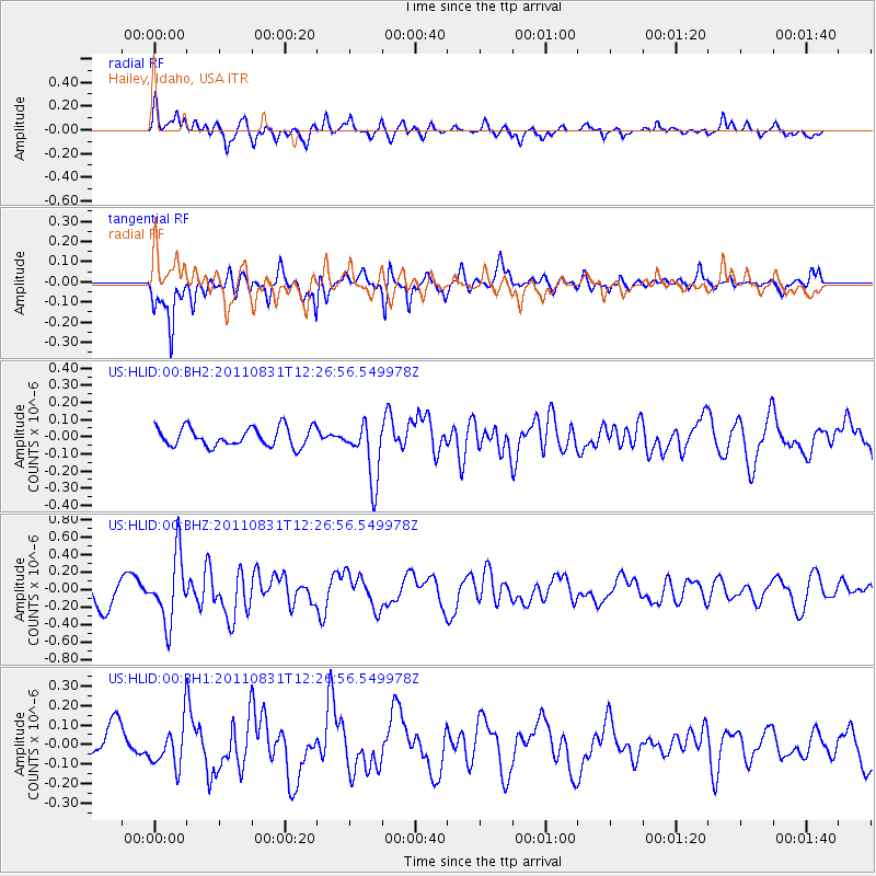
HLID Hailey, Idaho, USA - Earthquake Result Viewer
*The percent match for this event was below the threshold and hence no stack was calculated.
| Earthquake location: |
Northern Mid-Atlantic Ridge |
| Earthquake latitude/longitude: |
43.6/-28.9 |
| Earthquake time(UTC): |
2011/08/31 (243) 12:17:27 GMT |
| Earthquake Depth: |
10 km |
| Earthquake Magnitude: |
5.6 MW, 5.5 MW |
| Earthquake Catalog/Contributor: |
NEIC PDE/NEIC PDE-M |
|
| Network: |
US United States National Seismic Network |
| Station: |
HLID Hailey, Idaho, USA |
| Lat/Lon: |
43.56 N/114.41 W |
| Elevation: |
1772 m |
|
| Distance: |
59.1 deg |
| Az: |
302.399 deg |
| Baz: |
57.562 deg |
| Ray Param: |
$rayparam |
*The percent match for this event was below the threshold and hence was not used in the summary stack. |
|
| Radial Match: |
64.62045 % |
| Radial Bump: |
400 |
| Transverse Match: |
76.602455 % |
| Transverse Bump: |
359 |
| SOD ConfigId: |
558545 |
| Insert Time: |
2013-09-19 02:05:21.878 +0000 |
| GWidth: |
2.5 |
| Max Bumps: |
400 |
| Tol: |
0.001 |
|
Signal To Noise
| Channel | StoN | STA | LTA |
| US:HLID:00:BHZ:20110831T12:26:56.549978Z | 2.47108 | 3.8096928E-7 | 1.5417116E-7 |
| US:HLID:00:BH1:20110831T12:26:56.549978Z | 1.1893781 | 1.1219731E-7 | 9.4332755E-8 |
| US:HLID:00:BH2:20110831T12:26:56.549978Z | 3.1541164 | 1.7485834E-7 | 5.543814E-8 |
| Arrivals |
| Ps | |
| PpPs | |
| PsPs/PpSs | |


