You are here: Home > Network List > US - United States National Seismic Network Stations List
> Station LKWY Lake (Yellowstone--Lake), Wyoming, USA > Earthquake Result Viewer
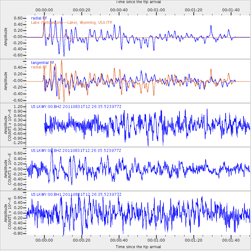
LKWY Lake (Yellowstone--Lake), Wyoming, USA - Earthquake Result Viewer
*The percent match for this event was below the threshold and hence no stack was calculated.
| Earthquake location: |
Northern Mid-Atlantic Ridge |
| Earthquake latitude/longitude: |
43.6/-28.9 |
| Earthquake time(UTC): |
2011/08/31 (243) 12:17:27 GMT |
| Earthquake Depth: |
10 km |
| Earthquake Magnitude: |
5.6 MW, 5.5 MW |
| Earthquake Catalog/Contributor: |
NEIC PDE/NEIC PDE-M |
|
| Network: |
US United States National Seismic Network |
| Station: |
LKWY Lake (Yellowstone--Lake), Wyoming, USA |
| Lat/Lon: |
44.57 N/110.40 W |
| Elevation: |
2424 m |
|
| Distance: |
56.1 deg |
| Az: |
301.636 deg |
| Baz: |
59.935 deg |
| Ray Param: |
$rayparam |
*The percent match for this event was below the threshold and hence was not used in the summary stack. |
|
| Radial Match: |
70.377396 % |
| Radial Bump: |
400 |
| Transverse Match: |
67.74986 % |
| Transverse Bump: |
400 |
| SOD ConfigId: |
558545 |
| Insert Time: |
2013-09-19 02:05:44.053 +0000 |
| GWidth: |
2.5 |
| Max Bumps: |
400 |
| Tol: |
0.001 |
|
Signal To Noise
| Channel | StoN | STA | LTA |
| US:LKWY:00:BHZ:20110831T12:26:35.523977Z | 2.4865232 | 3.3257135E-7 | 1.3374955E-7 |
| US:LKWY:00:BH1:20110831T12:26:35.523977Z | 0.8229507 | 1.7731524E-7 | 2.1546278E-7 |
| US:LKWY:00:BH2:20110831T12:26:35.523977Z | 1.1610361 | 3.2027506E-7 | 2.7585278E-7 |
| Arrivals |
| Ps | |
| PpPs | |
| PsPs/PpSs | |


