You are here: Home > Network List > US - United States National Seismic Network Stations List
> Station TPNV Topopah Spring, Nevada, USA > Earthquake Result Viewer
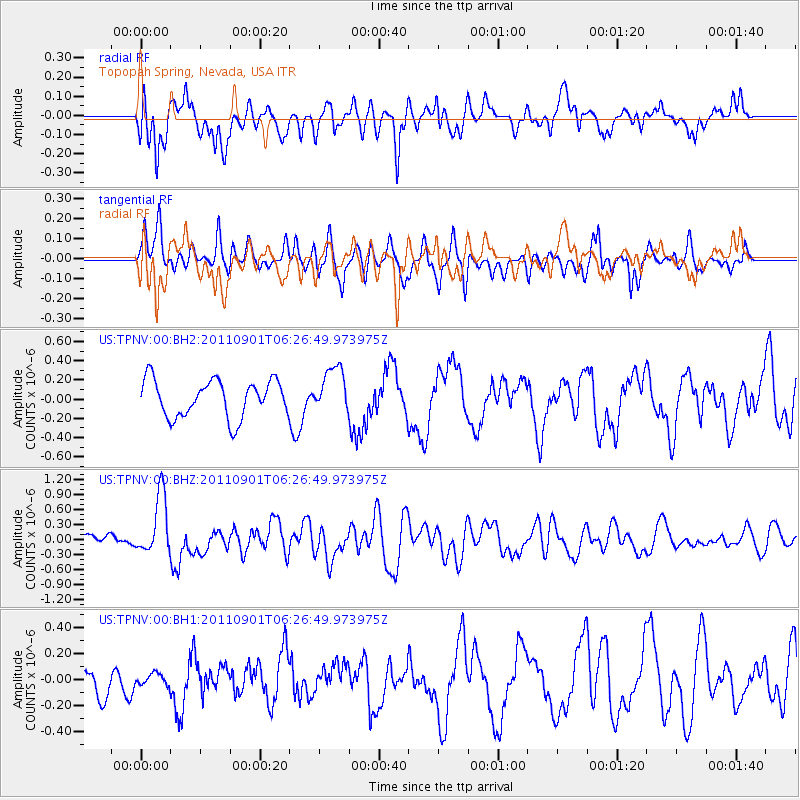
TPNV Topopah Spring, Nevada, USA - Earthquake Result Viewer
*The percent match for this event was below the threshold and hence no stack was calculated.
| Earthquake location: |
Santa Cruz Islands |
| Earthquake latitude/longitude: |
-12.4/166.7 |
| Earthquake time(UTC): |
2011/09/01 (244) 06:14:38 GMT |
| Earthquake Depth: |
39 km |
| Earthquake Magnitude: |
5.7 MB, 5.6 MS, 6.1 MW, 6.0 MW |
| Earthquake Catalog/Contributor: |
WHDF/NEIC |
|
| Network: |
US United States National Seismic Network |
| Station: |
TPNV Topopah Spring, Nevada, USA |
| Lat/Lon: |
36.95 N/116.25 W |
| Elevation: |
1600 m |
|
| Distance: |
87.3 deg |
| Az: |
51.421 deg |
| Baz: |
252.464 deg |
| Ray Param: |
$rayparam |
*The percent match for this event was below the threshold and hence was not used in the summary stack. |
|
| Radial Match: |
68.21557 % |
| Radial Bump: |
400 |
| Transverse Match: |
70.633865 % |
| Transverse Bump: |
400 |
| SOD ConfigId: |
558545 |
| Insert Time: |
2013-09-19 02:09:12.762 +0000 |
| GWidth: |
2.5 |
| Max Bumps: |
400 |
| Tol: |
0.001 |
|
Signal To Noise
| Channel | StoN | STA | LTA |
| US:TPNV:00:BHZ:20110901T06:26:49.973975Z | 3.094751 | 6.000451E-7 | 1.9389124E-7 |
| US:TPNV:00:BH1:20110901T06:26:49.973975Z | 0.24649899 | 4.286685E-8 | 1.7390275E-7 |
| US:TPNV:00:BH2:20110901T06:26:49.973975Z | 1.2382824 | 2.3916863E-7 | 1.9314547E-7 |
| Arrivals |
| Ps | |
| PpPs | |
| PsPs/PpSs | |


