
PFO Pinon Flat, California, USA - Earthquake Result Viewer
| ||||||||||||||||||
| ||||||||||||||||||
| ||||||||||||||||||
|
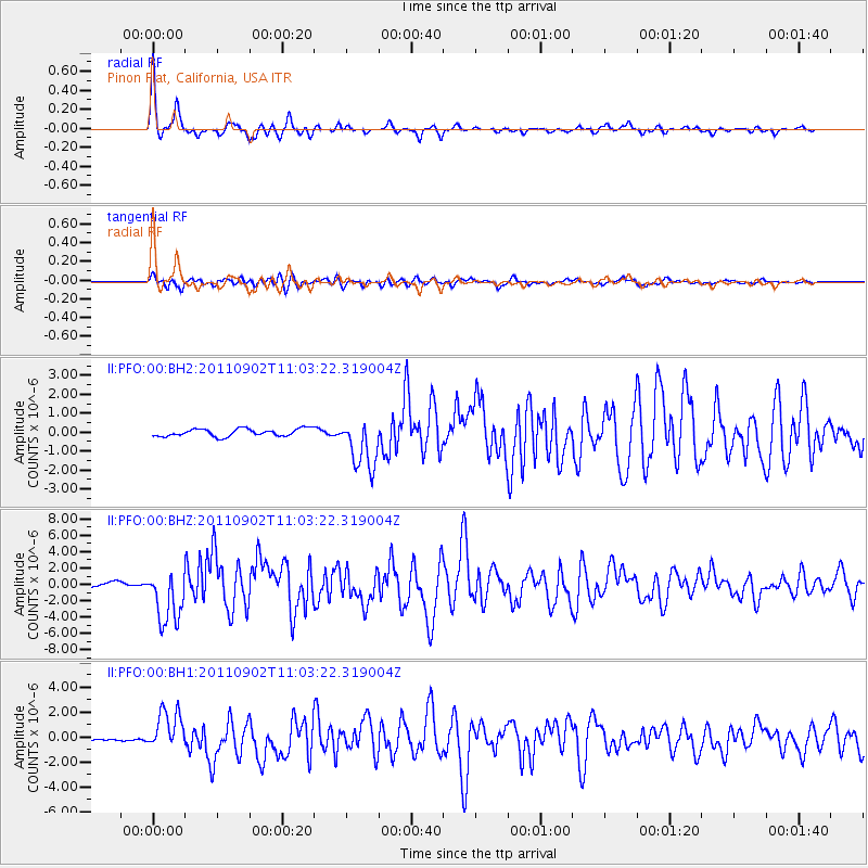
Signal To Noise
| Channel | StoN | STA | LTA |
| II:PFO:00:BHZ:20110902T11:03:22.319004Z | 12.542685 | 3.3622891E-6 | 2.6806774E-7 |
| II:PFO:00:BH1:20110902T11:03:22.319004Z | 10.758495 | 1.6118356E-6 | 1.4981981E-7 |
| II:PFO:00:BH2:20110902T11:03:22.319004Z | 6.7455254 | 1.3588693E-6 | 2.0144752E-7 |
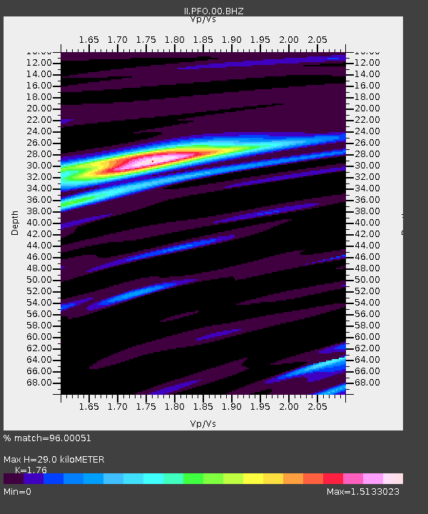
| Arrivals | |
| Ps | 3.7 SECOND |
| PpPs | 12 SECOND |
| PsPs/PpSs | 16 SECOND |

