COWI Conover, Wisconsin, USA - Earthquake Result Viewer
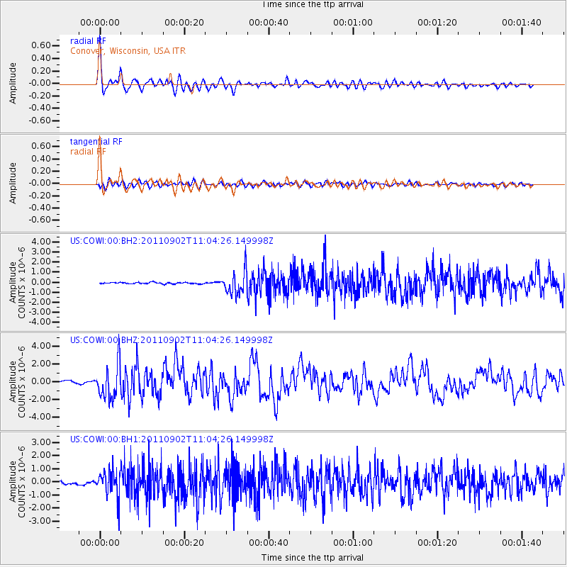
Earthquake location: Fox Islands, Aleutian Islands
Earthquake latitude/longitude: 52.2/-171.7
Earthquake time(UTC): 2011/09/02 (245) 10:55:53 GMT
Earthquake Depth: 32 km
Earthquake Magnitude: 6.5 MB, 6.9 MS, 6.8 MW, 6.8 MW
Earthquake Catalog/Contributor: WHDF/NEIC
Network: US United States National Seismic Network
Station: COWI Conover, Wisconsin, USA
Lat/Lon: 46.10 N/89.14 W
Elevation: 523 m
Distance: 51.6 deg
Az: 61.703 deg
Baz: 308.799 deg
Ray Param: 0.06725344
Estimated Moho Depth: 49.75 km
Estimated Crust Vp/Vs: 1.60
Assumed Crust Vp: 6.467 km/s
Estimated Crust Vs: 4.042 km/s
Estimated Crust Poisson's Ratio: 0.18
Radial Match: 93.84675 %
Radial Bump: 400
Transverse Match: 73.95411 %
Transverse Bump: 400
SOD ConfigId: 558545
Insert Time: 2013-09-19 02:12:55.489 +0000
GWidth: 2.5
Max Bumps: 400
Tol: 0.001

Signal To Noise

ChannelStoNSTALTA
US:COWI:00:BHZ:20110902T11:04:26.149998Z16.2632541.9728468E-61.2130701E-7
US:COWI:00:BH1:20110902T11:04:26.149998Z11.770391.0154876E-68.627476E-8
US:COWI:00:BH2:20110902T11:04:26.149998Z16.4582791.1310877E-66.8724546E-8
Arrivals
Ps4.9 SECOND
PpPs19 SECOND
PsPs/PpSs24 SECOND