
EGMT Eagleton, Montana, USA - Earthquake Result Viewer
| ||||||||||||||||||
| ||||||||||||||||||
| ||||||||||||||||||
|
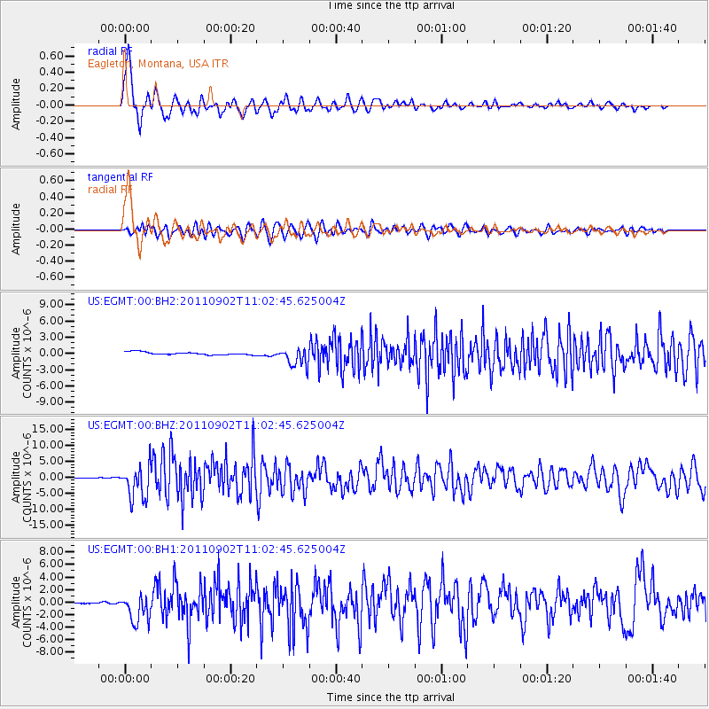
Signal To Noise
| Channel | StoN | STA | LTA |
| US:EGMT:00:BHZ:20110902T11:02:45.625004Z | 47.528397 | 5.306077E-6 | 1.1164015E-7 |
| US:EGMT:00:BH1:20110902T11:02:45.625004Z | 16.98019 | 2.312049E-6 | 1.3616155E-7 |
| US:EGMT:00:BH2:20110902T11:02:45.625004Z | 7.1292605 | 1.7616295E-6 | 2.470985E-7 |
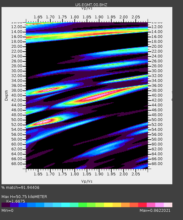
| Arrivals | |
| Ps | 5.7 SECOND |
| PpPs | 19 SECOND |
| PsPs/PpSs | 25 SECOND |

