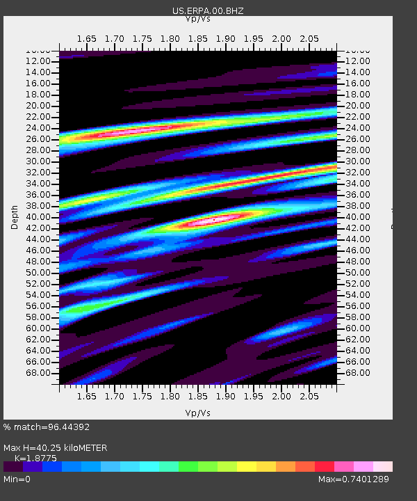
ERPA Erie, Pennsylvania, USA - Earthquake Result Viewer
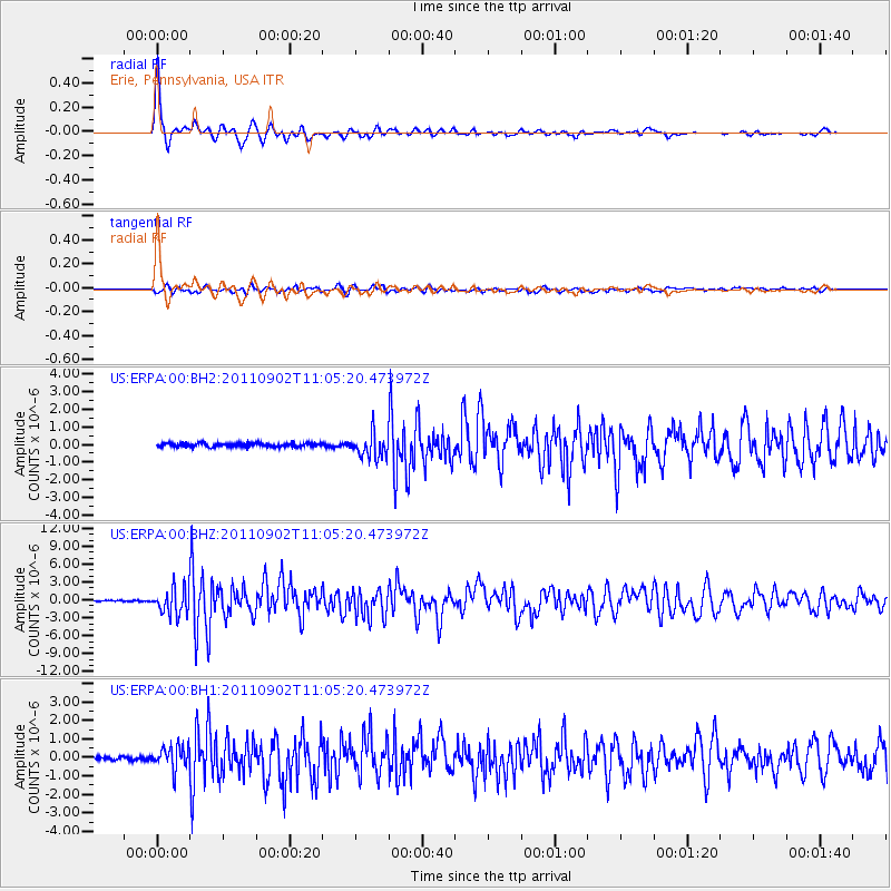
Earthquake location: Fox Islands, Aleutian Islands
Earthquake latitude/longitude: 52.2/-171.7
Earthquake time(UTC): 2011/09/02 (245) 10:55:53 GMT
Earthquake Depth: 32 km
Earthquake Magnitude: 6.5 MB, 6.9 MS, 6.8 MW, 6.8 MW
Earthquake Catalog/Contributor: WHDF/NEIC
Network: US United States National Seismic Network
Station: ERPA Erie, Pennsylvania, USA
Lat/Lon: 42.12 N/79.99 W
Elevation: 306 m
Distance: 59.2 deg
Az: 60.015 deg
Baz: 314.193 deg
Ray Param: 0.062318508
Estimated Moho Depth: 40.25 km
Estimated Crust Vp/Vs: 1.88
Assumed Crust Vp: 6.419 km/s
Estimated Crust Vs: 3.419 km/s
Estimated Crust Poisson's Ratio: 0.30
Radial Match: 96.44392 %
Radial Bump: 326
Transverse Match: 82.452805 %
Transverse Bump: 400
SOD ConfigId: 558545
Insert Time: 2013-09-19 02:13:07.656 +0000
GWidth: 2.5
Max Bumps: 400
Tol: 0.001

Signal To Noise

ChannelStoNSTALTA
US:ERPA:00:BHZ:20110902T11:05:20.473972Z19.8973462.1968426E-61.1040882E-7
US:ERPA:00:BH1:20110902T11:05:20.473972Z5.49164156.1597945E-71.1216673E-7
US:ERPA:00:BH2:20110902T11:05:20.473972Z6.67669446.912702E-71.03534795E-7
Arrivals
Ps5.8 SECOND
PpPs17 SECOND
PsPs/PpSs23 SECOND