
EYMN Ely, Minnesota, USA - Earthquake Result Viewer
| ||||||||||||||||||
| ||||||||||||||||||
| ||||||||||||||||||
|
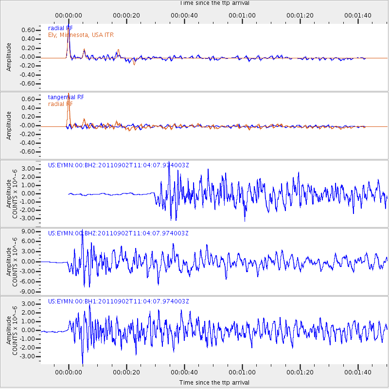
Signal To Noise
| Channel | StoN | STA | LTA |
| US:EYMN:00:BHZ:20110902T11:04:07.974003Z | 22.832878 | 3.0233439E-6 | 1.3241187E-7 |
| US:EYMN:00:BH1:20110902T11:04:07.974003Z | 14.745711 | 1.1249771E-6 | 7.629181E-8 |
| US:EYMN:00:BH2:20110902T11:04:07.974003Z | 17.789888 | 1.2788599E-6 | 7.18869E-8 |
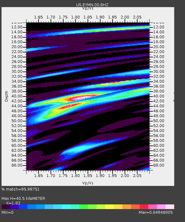
| Arrivals | |
| Ps | 5.4 SECOND |
| PpPs | 17 SECOND |
| PsPs/PpSs | 22 SECOND |

