GOGA Godfrey, Georgia, USA - Earthquake Result Viewer
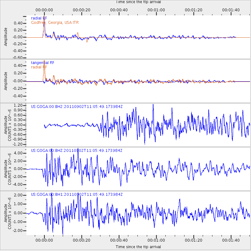
Earthquake location: Fox Islands, Aleutian Islands
Earthquake latitude/longitude: 52.2/-171.7
Earthquake time(UTC): 2011/09/02 (245) 10:55:53 GMT
Earthquake Depth: 32 km
Earthquake Magnitude: 6.5 MB, 6.9 MS, 6.8 MW, 6.8 MW
Earthquake Catalog/Contributor: WHDF/NEIC
Network: US United States National Seismic Network
Station: GOGA Godfrey, Georgia, USA
Lat/Lon: 33.41 N/83.47 W
Elevation: 150 m
Distance: 63.4 deg
Az: 69.216 deg
Baz: 316.497 deg
Ray Param: 0.05954389
Estimated Moho Depth: 36.5 km
Estimated Crust Vp/Vs: 1.88
Assumed Crust Vp: 6.565 km/s
Estimated Crust Vs: 3.487 km/s
Estimated Crust Poisson's Ratio: 0.30
Radial Match: 95.00741 %
Radial Bump: 400
Transverse Match: 84.0879 %
Transverse Bump: 400
SOD ConfigId: 558545
Insert Time: 2013-09-19 02:13:18.430 +0000
GWidth: 2.5
Max Bumps: 400
Tol: 0.001

Signal To Noise

ChannelStoNSTALTA
US:GOGA:00:BHZ:20110902T11:05:49.173984Z22.5215232.40167E-61.0663888E-7
US:GOGA:00:BH1:20110902T11:05:49.173984Z12.7693621.0675799E-68.360479E-8
US:GOGA:00:BH2:20110902T11:05:49.173984Z7.2170933.9339386E-75.450863E-8
Arrivals
Ps5.1 SECOND
PpPs15 SECOND
PsPs/PpSs20 SECOND