You are here: Home > Network List > CN - Canadian National Seismograph Network Stations List
> Station INK INUVIK, NT, CANADA.ANADA > Earthquake Result Viewer
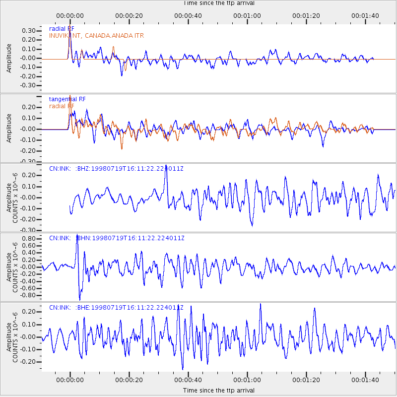
INK INUVIK, NT, CANADA.ANADA - Earthquake Result Viewer
*The percent match for this event was below the threshold and hence no stack was calculated.
| Earthquake location: |
Tonga Islands |
| Earthquake latitude/longitude: |
-21.8/-175.8 |
| Earthquake time(UTC): |
1998/07/19 (200) 15:58:38 GMT |
| Earthquake Depth: |
72 km |
| Earthquake Magnitude: |
5.9 MB, 6.1 UNKNOWN, 6.0 MW |
| Earthquake Catalog/Contributor: |
WHDF/NEIC |
|
| Network: |
CN Canadian National Seismograph Network |
| Station: |
INK INUVIK, NT, CANADA.ANADA |
| Lat/Lon: |
68.31 N/133.52 W |
| Elevation: |
40 m |
|
| Distance: |
95.0 deg |
| Az: |
14.54 deg |
| Baz: |
218.857 deg |
| Ray Param: |
$rayparam |
*The percent match for this event was below the threshold and hence was not used in the summary stack. |
|
| Radial Match: |
69.00835 % |
| Radial Bump: |
400 |
| Transverse Match: |
74.07344 % |
| Transverse Bump: |
400 |
| SOD ConfigId: |
4480 |
| Insert Time: |
2010-02-27 06:22:20.081 +0000 |
| GWidth: |
2.5 |
| Max Bumps: |
400 |
| Tol: |
0.001 |
|
Signal To Noise
| Channel | StoN | STA | LTA |
| CN:INK: :BHN:19980719T16:11:22.224011Z | 4.81178 | 4.497293E-7 | 9.346422E-8 |
| CN:INK: :BHE:19980719T16:11:22.224011Z | 1.4392265 | 8.638983E-8 | 6.002518E-8 |
| CN:INK: :BHZ:19980719T16:11:22.224011Z | 2.152341 | 1.15420335E-7 | 5.362549E-8 |
| Arrivals |
| Ps | |
| PpPs | |
| PsPs/PpSs | |


