
HDIL Hopedale, Illinois, USA - Earthquake Result Viewer
| ||||||||||||||||||
| ||||||||||||||||||
| ||||||||||||||||||
|
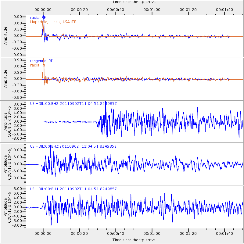
Signal To Noise
| Channel | StoN | STA | LTA |
| US:HDIL:00:BHZ:20110902T11:04:51.824985Z | 41.324955 | 4.2662346E-6 | 1.0323628E-7 |
| US:HDIL:00:BH1:20110902T11:04:51.824985Z | 23.974163 | 2.5064164E-6 | 1.0454656E-7 |
| US:HDIL:00:BH2:20110902T11:04:51.824985Z | 23.818422 | 2.7772942E-6 | 1.1660278E-7 |
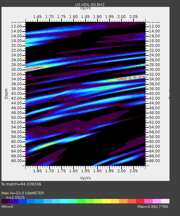
| Arrivals | |
| Ps | 5.6 SECOND |
| PpPs | 15 SECOND |
| PsPs/PpSs | 20 SECOND |

