KSU1 Kansas State University--Konza Prairie, Kansas, USA - Earthquake Result Viewer
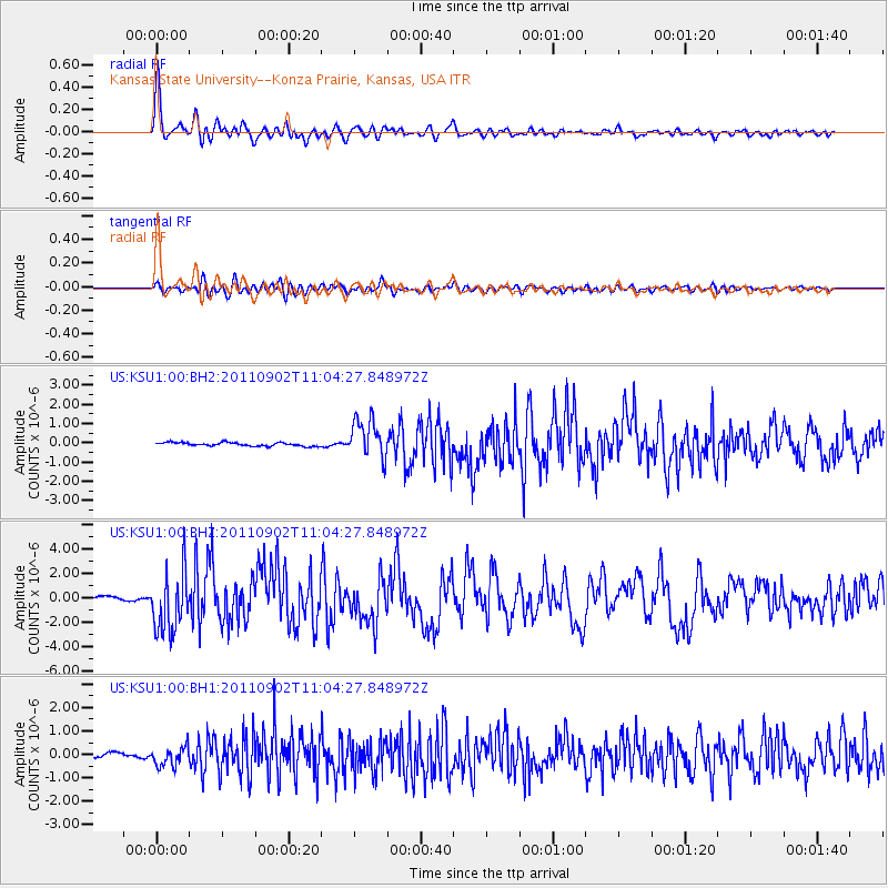
Earthquake location: Fox Islands, Aleutian Islands
Earthquake latitude/longitude: 52.2/-171.7
Earthquake time(UTC): 2011/09/02 (245) 10:55:53 GMT
Earthquake Depth: 32 km
Earthquake Magnitude: 6.5 MB, 6.9 MS, 6.8 MW, 6.8 MW
Earthquake Catalog/Contributor: WHDF/NEIC
Network: US United States National Seismic Network
Station: KSU1 Kansas State University--Konza Prairie, Kansas, USA
Lat/Lon: 39.10 N/96.61 W
Elevation: 347 m
Distance: 51.8 deg
Az: 73.047 deg
Baz: 310.79 deg
Ray Param: 0.0671007
Estimated Moho Depth: 37.5 km
Estimated Crust Vp/Vs: 2.01
Assumed Crust Vp: 6.483 km/s
Estimated Crust Vs: 3.229 km/s
Estimated Crust Poisson's Ratio: 0.33
Radial Match: 94.40181 %
Radial Bump: 400
Transverse Match: 82.51497 %
Transverse Bump: 400
SOD ConfigId: 558545
Insert Time: 2013-09-19 02:13:37.118 +0000
GWidth: 2.5
Max Bumps: 400
Tol: 0.001

Signal To Noise

ChannelStoNSTALTA
US:KSU1:00:BHZ:20110902T11:04:27.848972Z16.1574692.468987E-61.5280779E-7
US:KSU1:00:BH1:20110902T11:04:27.848972Z3.4180834.0174135E-71.17534114E-7
US:KSU1:00:BH2:20110902T11:04:27.848972Z10.8413911.0086044E-69.303275E-8
Arrivals
Ps6.1 SECOND
PpPs17 SECOND
PsPs/PpSs23 SECOND