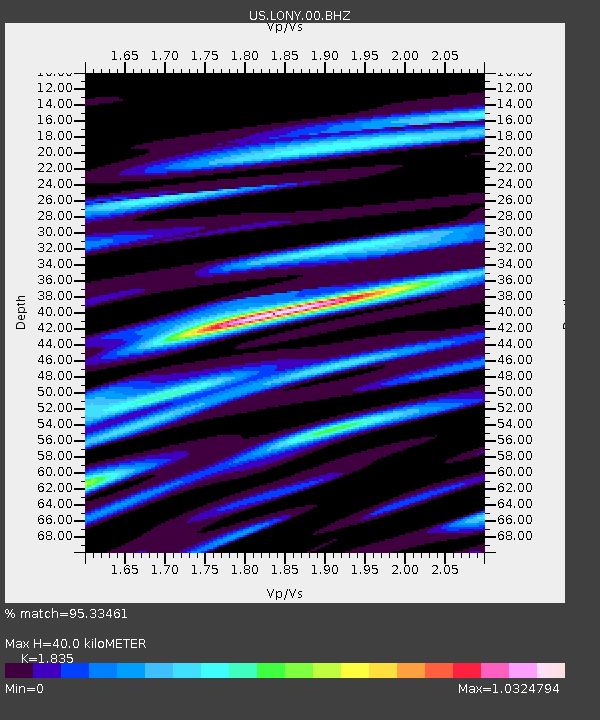
LONY Lake Ozonia, New York, USA - Earthquake Result Viewer
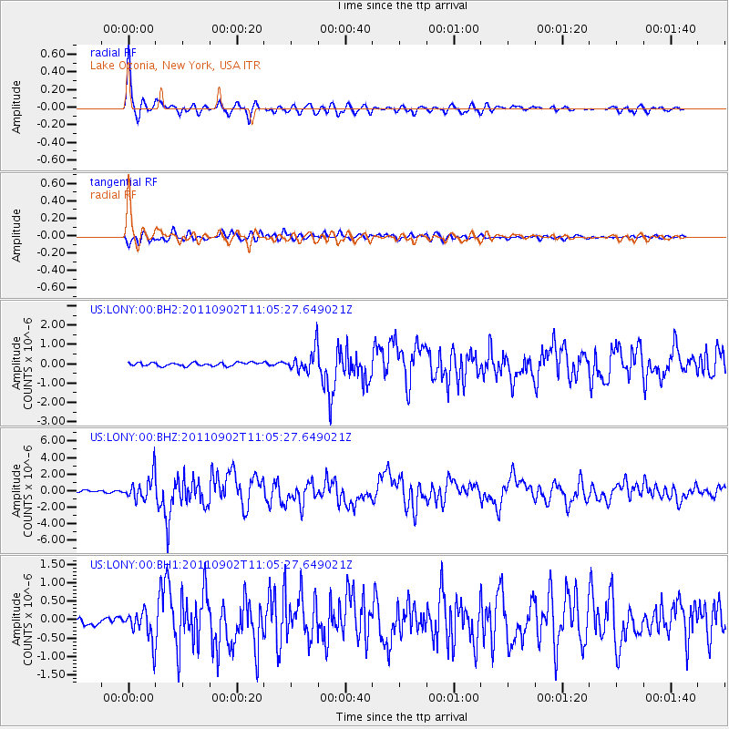
Earthquake location: Fox Islands, Aleutian Islands
Earthquake latitude/longitude: 52.2/-171.7
Earthquake time(UTC): 2011/09/02 (245) 10:55:53 GMT
Earthquake Depth: 32 km
Earthquake Magnitude: 6.5 MB, 6.9 MS, 6.8 MW, 6.8 MW
Earthquake Catalog/Contributor: WHDF/NEIC
Network: US United States National Seismic Network
Station: LONY Lake Ozonia, New York, USA
Lat/Lon: 44.62 N/74.58 W
Elevation: 440 m
Distance: 60.2 deg
Az: 54.745 deg
Baz: 315.233 deg
Ray Param: 0.061633978
Estimated Moho Depth: 40.0 km
Estimated Crust Vp/Vs: 1.84
Assumed Crust Vp: 6.419 km/s
Estimated Crust Vs: 3.498 km/s
Estimated Crust Poisson's Ratio: 0.29
Radial Match: 95.33461 %
Radial Bump: 400
Transverse Match: 87.875496 %
Transverse Bump: 400
SOD ConfigId: 558545
Insert Time: 2013-09-19 02:13:54.907 +0000
GWidth: 2.5
Max Bumps: 400
Tol: 0.001

Signal To Noise

ChannelStoNSTALTA
US:LONY:00:BHZ:20110902T11:05:27.649021Z14.6481881.4799301E-61.0103162E-7
US:LONY:00:BH1:20110902T11:05:27.649021Z5.2550274.1013456E-77.804614E-8
US:LONY:00:BH2:20110902T11:05:27.649021Z6.8312075.949407E-78.709159E-8
Arrivals
Ps5.4 SECOND
PpPs17 SECOND
PsPs/PpSs22 SECOND