MSO Missoula, Montana, USA - Earthquake Result Viewer
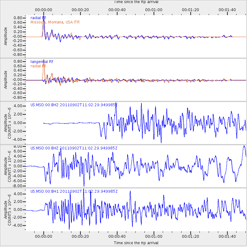
Earthquake location: Fox Islands, Aleutian Islands
Earthquake latitude/longitude: 52.2/-171.7
Earthquake time(UTC): 2011/09/02 (245) 10:55:53 GMT
Earthquake Depth: 32 km
Earthquake Magnitude: 6.5 MB, 6.9 MS, 6.8 MW, 6.8 MW
Earthquake Catalog/Contributor: WHDF/NEIC
Network: US United States National Seismic Network
Station: MSO Missoula, Montana, USA
Lat/Lon: 46.83 N/113.94 W
Elevation: 1264 m
Distance: 37.0 deg
Az: 74.668 deg
Baz: 300.112 deg
Ray Param: 0.07629984
Estimated Moho Depth: 26.0 km
Estimated Crust Vp/Vs: 2.05
Assumed Crust Vp: 6.353 km/s
Estimated Crust Vs: 3.103 km/s
Estimated Crust Poisson's Ratio: 0.34
Radial Match: 93.933365 %
Radial Bump: 400
Transverse Match: 73.69638 %
Transverse Bump: 400
SOD ConfigId: 558545
Insert Time: 2013-09-19 02:14:07.108 +0000
GWidth: 2.5
Max Bumps: 400
Tol: 0.001

Signal To Noise

ChannelStoNSTALTA
US:MSO:00:BHZ:20110902T11:02:29.949985Z23.8418713.1573613E-61.3242926E-7
US:MSO:00:BH1:20110902T11:02:29.949985Z19.1784171.2110967E-66.314894E-8
US:MSO:00:BH2:20110902T11:02:29.949985Z22.1542631.754539E-67.9196454E-8
Arrivals
Ps4.6 SECOND
PpPs12 SECOND
PsPs/PpSs16 SECOND