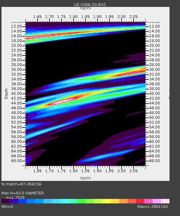
OGNE Ogallala, Nebraska, USA - Earthquake Result Viewer
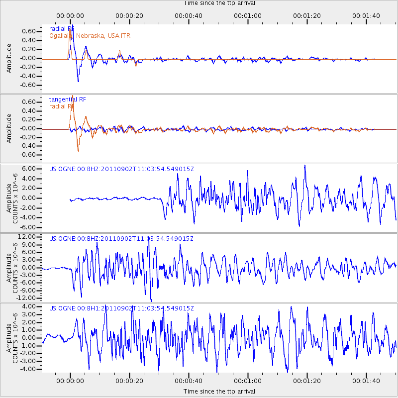
Earthquake location: Fox Islands, Aleutian Islands
Earthquake latitude/longitude: 52.2/-171.7
Earthquake time(UTC): 2011/09/02 (245) 10:55:53 GMT
Earthquake Depth: 32 km
Earthquake Magnitude: 6.5 MB, 6.9 MS, 6.8 MW, 6.8 MW
Earthquake Catalog/Contributor: WHDF/NEIC
Network: US United States National Seismic Network
Station: OGNE Ogallala, Nebraska, USA
Lat/Lon: 40.95 N/102.03 W
Elevation: 0.0 m
Distance: 47.4 deg
Az: 74.668 deg
Baz: 308.364 deg
Ray Param: 0.0699253
Estimated Moho Depth: 43.0 km
Estimated Crust Vp/Vs: 1.75
Assumed Crust Vp: 6.483 km/s
Estimated Crust Vs: 3.699 km/s
Estimated Crust Poisson's Ratio: 0.26
Radial Match: 97.494156 %
Radial Bump: 400
Transverse Match: 84.373276 %
Transverse Bump: 400
SOD ConfigId: 558545
Insert Time: 2013-09-19 02:14:22.755 +0000
GWidth: 2.5
Max Bumps: 400
Tol: 0.001

Signal To Noise

ChannelStoNSTALTA
US:OGNE:00:BHZ:20110902T11:03:54.549015Z25.7959024.5620363E-61.768512E-7
US:OGNE:00:BH1:20110902T11:03:54.549015Z5.02403071.2761727E-62.5401374E-7
US:OGNE:00:BH2:20110902T11:03:54.549015Z10.4658031.8440992E-61.7620235E-7
Arrivals
Ps5.3 SECOND
PpPs17 SECOND
PsPs/PpSs22 SECOND