
OXF Oxford, Mississippi, USA - Earthquake Result Viewer
| ||||||||||||||||||
| ||||||||||||||||||
| ||||||||||||||||||
|
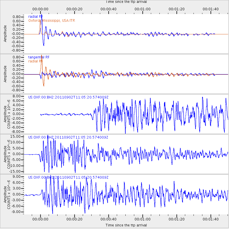
Signal To Noise
| Channel | StoN | STA | LTA |
| US:OXF:00:BHZ:20110902T11:05:20.574009Z | 85.811775 | 6.890974E-6 | 8.030336E-8 |
| US:OXF:00:BH1:20110902T11:05:20.574009Z | 20.447998 | 2.9802727E-6 | 1.4574887E-7 |
| US:OXF:00:BH2:20110902T11:05:20.574009Z | 14.339344 | 2.6438183E-6 | 1.8437514E-7 |
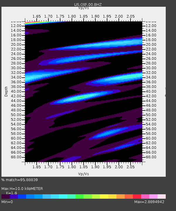
| Arrivals | |
| Ps | 1.0 SECOND |
| PpPs | 3.9 SECOND |
| PsPs/PpSs | 4.9 SECOND |

