SDCO Great Sand Dunes National Park, Colorado, USA - Earthquake Result Viewer
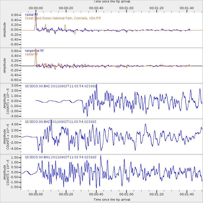
Earthquake location: Fox Islands, Aleutian Islands
Earthquake latitude/longitude: 52.2/-171.7
Earthquake time(UTC): 2011/09/02 (245) 10:55:53 GMT
Earthquake Depth: 32 km
Earthquake Magnitude: 6.5 MB, 6.9 MS, 6.8 MW, 6.8 MW
Earthquake Catalog/Contributor: WHDF/NEIC
Network: US United States National Seismic Network
Station: SDCO Great Sand Dunes National Park, Colorado, USA
Lat/Lon: 37.75 N/105.50 W
Elevation: 2569 m
Distance: 47.4 deg
Az: 80.34 deg
Baz: 310.013 deg
Ray Param: 0.069969274
Estimated Moho Depth: 33.0 km
Estimated Crust Vp/Vs: 2.04
Assumed Crust Vp: 6.316 km/s
Estimated Crust Vs: 3.096 km/s
Estimated Crust Poisson's Ratio: 0.34
Radial Match: 97.13421 %
Radial Bump: 275
Transverse Match: 85.156654 %
Transverse Bump: 400
SOD ConfigId: 558545
Insert Time: 2013-09-19 02:14:35.124 +0000
GWidth: 2.5
Max Bumps: 400
Tol: 0.001

Signal To Noise

ChannelStoNSTALTA
US:SDCO:00:BHZ:20110902T11:03:54.02399Z14.1356482.40109E-61.6986061E-7
US:SDCO:00:BH1:20110902T11:03:54.02399Z5.243545.221961E-79.958846E-8
US:SDCO:00:BH2:20110902T11:03:54.02399Z8.6850251.2864296E-61.4812042E-7
Arrivals
Ps5.7 SECOND
PpPs15 SECOND
PsPs/PpSs21 SECOND