TZTN Tazewell, Tennessee, USA - Earthquake Result Viewer
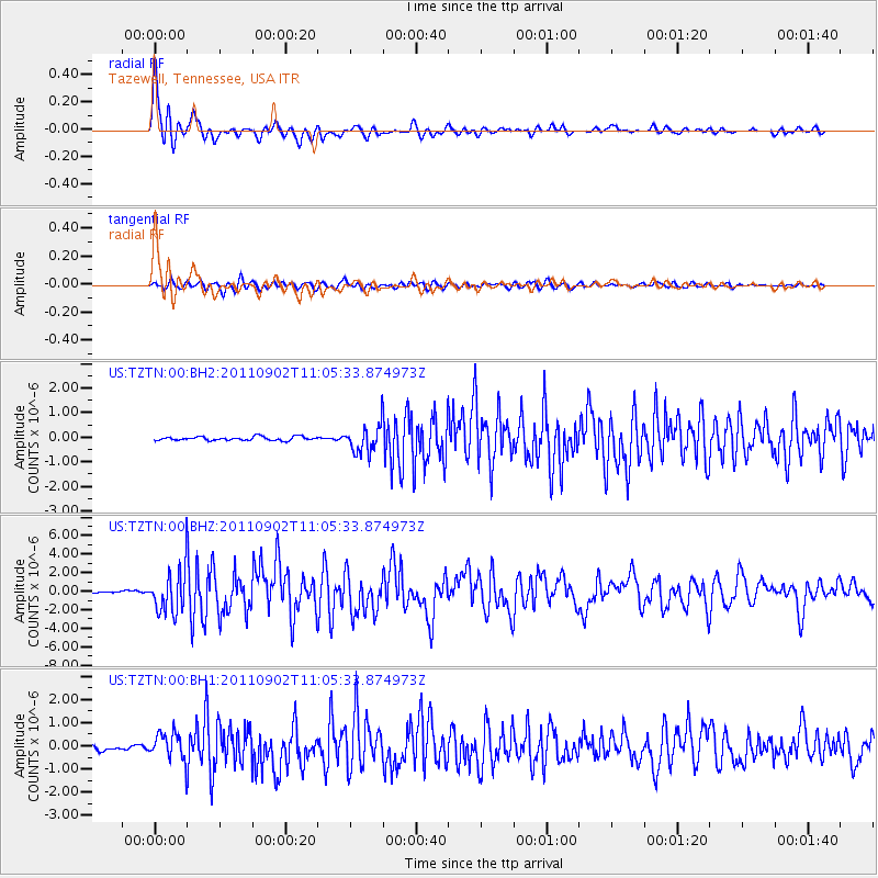
Earthquake location: Fox Islands, Aleutian Islands
Earthquake latitude/longitude: 52.2/-171.7
Earthquake time(UTC): 2011/09/02 (245) 10:55:53 GMT
Earthquake Depth: 32 km
Earthquake Magnitude: 6.5 MB, 6.9 MS, 6.8 MW, 6.8 MW
Earthquake Catalog/Contributor: WHDF/NEIC
Network: US United States National Seismic Network
Station: TZTN Tazewell, Tennessee, USA
Lat/Lon: 36.54 N/83.55 W
Elevation: 394 m
Distance: 61.1 deg
Az: 66.814 deg
Baz: 315.332 deg
Ray Param: 0.061029274
Estimated Moho Depth: 13.25 km
Estimated Crust Vp/Vs: 1.96
Assumed Crust Vp: 6.476 km/s
Estimated Crust Vs: 3.3 km/s
Estimated Crust Poisson's Ratio: 0.32
Radial Match: 95.12045 %
Radial Bump: 400
Transverse Match: 86.739044 %
Transverse Bump: 400
SOD ConfigId: 558545
Insert Time: 2013-09-19 02:14:40.875 +0000
GWidth: 2.5
Max Bumps: 400
Tol: 0.001

Signal To Noise

ChannelStoNSTALTA
US:TZTN:00:BHZ:20110902T11:05:33.874973Z30.4049662.3105886E-67.599378E-8
US:TZTN:00:BH1:20110902T11:05:33.874973Z7.64475255.885851E-77.6992045E-8
US:TZTN:00:BH2:20110902T11:05:33.874973Z7.1164775.420614E-77.616991E-8
Arrivals
Ps2.1 SECOND
PpPs5.8 SECOND
PsPs/PpSs7.9 SECOND