WMOK Wichita Mountains, Oklahoma, USA - Earthquake Result Viewer
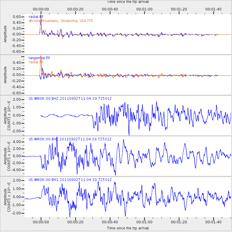
Earthquake location: Fox Islands, Aleutian Islands
Earthquake latitude/longitude: 52.2/-171.7
Earthquake time(UTC): 2011/09/02 (245) 10:55:53 GMT
Earthquake Depth: 32 km
Earthquake Magnitude: 6.5 MB, 6.9 MS, 6.8 MW, 6.8 MW
Earthquake Catalog/Contributor: WHDF/NEIC
Network: US United States National Seismic Network
Station: WMOK Wichita Mountains, Oklahoma, USA
Lat/Lon: 34.74 N/98.78 W
Elevation: 486 m
Distance: 53.4 deg
Az: 78.592 deg
Baz: 312.857 deg
Ray Param: 0.0660456
Estimated Moho Depth: 39.0 km
Estimated Crust Vp/Vs: 1.99
Assumed Crust Vp: 6.315 km/s
Estimated Crust Vs: 3.177 km/s
Estimated Crust Poisson's Ratio: 0.33
Radial Match: 95.3723 %
Radial Bump: 400
Transverse Match: 91.37256 %
Transverse Bump: 400
SOD ConfigId: 558545
Insert Time: 2013-09-19 02:14:46.328 +0000
GWidth: 2.5
Max Bumps: 400
Tol: 0.001

Signal To Noise

ChannelStoNSTALTA
US:WMOK:00:BHZ:20110902T11:04:39.72501Z17.1056732.1391327E-61.2505399E-7
US:WMOK:00:BH1:20110902T11:04:39.72501Z4.10422237.493438E-71.8257877E-7
US:WMOK:00:BH2:20110902T11:04:39.72501Z8.4796789.0170016E-71.0633661E-7
Arrivals
Ps6.4 SECOND
PpPs18 SECOND
PsPs/PpSs24 SECOND