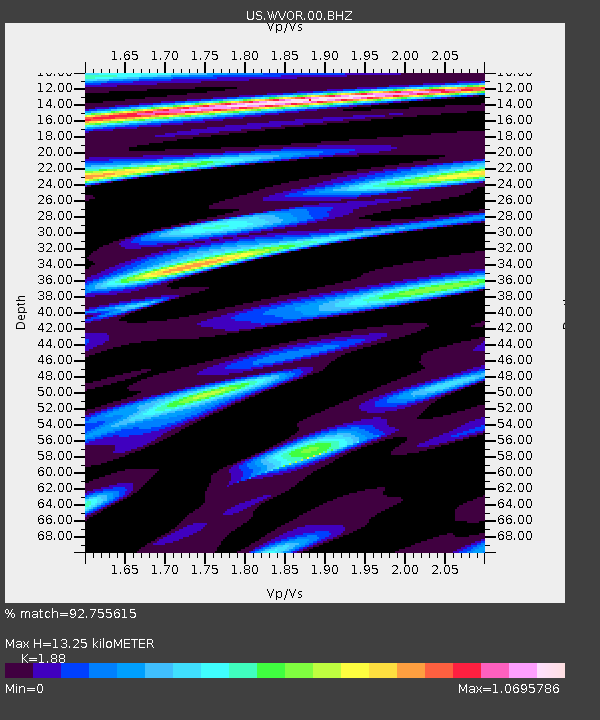
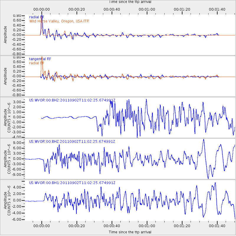
WVOR Wild Horse Valley, Oregon, USA - Earthquake Result Viewer

Earthquake location: Fox Islands, Aleutian Islands
Earthquake latitude/longitude: 52.2/-171.7
Earthquake time(UTC): 2011/09/02 (245) 10:55:53 GMT
Earthquake Depth: 32 km
Earthquake Magnitude: 6.5 MB, 6.9 MS, 6.8 MW, 6.8 MW
Earthquake Catalog/Contributor: WHDF/NEIC
Network: US United States National Seismic Network
Station: WVOR Wild Horse Valley, Oregon, USA
Lat/Lon: 42.43 N/118.64 W
Elevation: 1344 m
Distance: 36.5 deg
Az: 83.865 deg
Baz: 304.192 deg
Ray Param: 0.0765738
Estimated Moho Depth: 13.25 km
Estimated Crust Vp/Vs: 1.88
Assumed Crust Vp: 6.279 km/s
Estimated Crust Vs: 3.34 km/s
Estimated Crust Poisson's Ratio: 0.30
Radial Match: 92.755615 %
Radial Bump: 398
Transverse Match: 83.48188 %
Transverse Bump: 400
SOD ConfigId: 558545
Insert Time: 2013-09-19 02:14:52.669 +0000
GWidth: 2.5
Max Bumps: 400
Tol: 0.001

Signal To Noise

ChannelStoNSTALTA
US:WVOR:00:BHZ:20110902T11:02:25.674991Z30.1825683.5915568E-61.18994414E-7
US:WVOR:00:BH1:20110902T11:02:25.674991Z15.5646481.1135271E-67.154207E-8
US:WVOR:00:BH2:20110902T11:02:25.674991Z13.8600861.6855455E-61.2161148E-7
Arrivals
Ps2.0 SECOND
PpPs5.7 SECOND
PsPs/PpSs7.7 SECOND