You are here: Home > Network List > CU - Caribbean Network (USGS) Stations List
> Station BBGH Gun Hill, Barbados > Earthquake Result Viewer
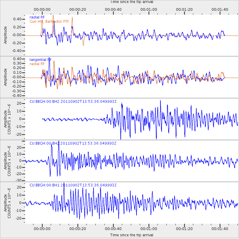
BBGH Gun Hill, Barbados - Earthquake Result Viewer
*The percent match for this event was below the threshold and hence no stack was calculated.
| Earthquake location: |
Santiago Del Estero Prov., Arg. |
| Earthquake latitude/longitude: |
-28.4/-63.0 |
| Earthquake time(UTC): |
2011/09/02 (245) 13:47:09 GMT |
| Earthquake Depth: |
579 km |
| Earthquake Magnitude: |
6.4 MB, 6.7 MW, 6.7 MW |
| Earthquake Catalog/Contributor: |
WHDF/NEIC |
|
| Network: |
CU Caribbean Network (USGS) |
| Station: |
BBGH Gun Hill, Barbados |
| Lat/Lon: |
13.14 N/59.56 W |
| Elevation: |
180 m |
|
| Distance: |
41.4 deg |
| Az: |
5.112 deg |
| Baz: |
184.622 deg |
| Ray Param: |
$rayparam |
*The percent match for this event was below the threshold and hence was not used in the summary stack. |
|
| Radial Match: |
61.071766 % |
| Radial Bump: |
400 |
| Transverse Match: |
63.316822 % |
| Transverse Bump: |
400 |
| SOD ConfigId: |
558545 |
| Insert Time: |
2013-09-19 02:15:15.274 +0000 |
| GWidth: |
2.5 |
| Max Bumps: |
400 |
| Tol: |
0.001 |
|
Signal To Noise
| Channel | StoN | STA | LTA |
| CU:BBGH:00:BHZ:20110902T13:53:36.049993Z | 5.0855937 | 6.207099E-6 | 1.220526E-6 |
| CU:BBGH:00:BH1:20110902T13:53:36.049993Z | 0.79257077 | 9.987011E-7 | 1.2600782E-6 |
| CU:BBGH:00:BH2:20110902T13:53:36.049993Z | 0.68561304 | 6.269521E-7 | 9.144402E-7 |
| Arrivals |
| Ps | |
| PpPs | |
| PsPs/PpSs | |


