You are here: Home > Network List > CN - Canadian National Seismograph Network Stations List
> Station INK INUVIK, NT, CANADA.ANADA > Earthquake Result Viewer
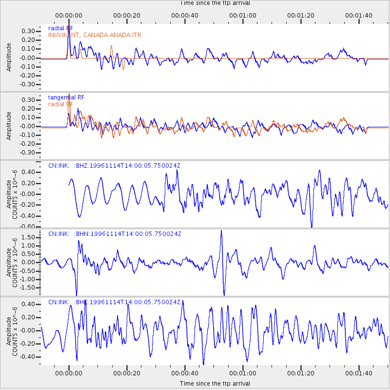
INK INUVIK, NT, CANADA.ANADA - Earthquake Result Viewer
*The percent match for this event was below the threshold and hence no stack was calculated.
| Earthquake location: |
Fiji Islands Region |
| Earthquake latitude/longitude: |
-21.2/-176.6 |
| Earthquake time(UTC): |
1996/11/14 (319) 13:47:38 GMT |
| Earthquake Depth: |
192 km |
| Earthquake Magnitude: |
5.9 MB, 6.2 UNKNOWN, 6.1 MW |
| Earthquake Catalog/Contributor: |
WHDF/NEIC |
|
| Network: |
CN Canadian National Seismograph Network |
| Station: |
INK INUVIK, NT, CANADA.ANADA |
| Lat/Lon: |
68.31 N/133.52 W |
| Elevation: |
40 m |
|
| Distance: |
94.6 deg |
| Az: |
14.766 deg |
| Baz: |
219.758 deg |
| Ray Param: |
$rayparam |
*The percent match for this event was below the threshold and hence was not used in the summary stack. |
|
| Radial Match: |
52.94542 % |
| Radial Bump: |
400 |
| Transverse Match: |
54.398052 % |
| Transverse Bump: |
400 |
| SOD ConfigId: |
4480 |
| Insert Time: |
2010-02-27 06:22:31.321 +0000 |
| GWidth: |
2.5 |
| Max Bumps: |
400 |
| Tol: |
0.001 |
|
Signal To Noise
| Channel | StoN | STA | LTA |
| CN:INK: :BHN:19961114T14:00:05.750024Z | 4.6791406 | 7.7492535E-7 | 1.6561275E-7 |
| CN:INK: :BHE:19961114T14:00:05.750024Z | 1.4150187 | 2.4471547E-7 | 1.7294151E-7 |
| CN:INK: :BHZ:19961114T14:00:05.750024Z | 1.0296978 | 1.8487317E-7 | 1.795412E-7 |
| Arrivals |
| Ps | |
| PpPs | |
| PsPs/PpSs | |


