You are here: Home > Network List > US - United States National Seismic Network Stations List
> Station HAWA Hanford, Washington, USA > Earthquake Result Viewer
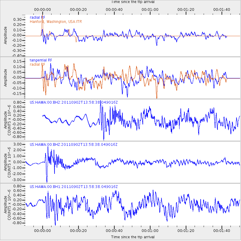
HAWA Hanford, Washington, USA - Earthquake Result Viewer
*The percent match for this event was below the threshold and hence no stack was calculated.
| Earthquake location: |
Santiago Del Estero Prov., Arg. |
| Earthquake latitude/longitude: |
-28.4/-63.0 |
| Earthquake time(UTC): |
2011/09/02 (245) 13:47:09 GMT |
| Earthquake Depth: |
579 km |
| Earthquake Magnitude: |
6.4 MB, 6.7 MW, 6.7 MW |
| Earthquake Catalog/Contributor: |
WHDF/NEIC |
|
| Network: |
US United States National Seismic Network |
| Station: |
HAWA Hanford, Washington, USA |
| Lat/Lon: |
46.39 N/119.53 W |
| Elevation: |
364 m |
|
| Distance: |
90.3 deg |
| Az: |
324.746 deg |
| Baz: |
132.719 deg |
| Ray Param: |
$rayparam |
*The percent match for this event was below the threshold and hence was not used in the summary stack. |
|
| Radial Match: |
79.3978 % |
| Radial Bump: |
400 |
| Transverse Match: |
74.235794 % |
| Transverse Bump: |
400 |
| SOD ConfigId: |
558545 |
| Insert Time: |
2013-09-19 02:17:36.012 +0000 |
| GWidth: |
2.5 |
| Max Bumps: |
400 |
| Tol: |
0.001 |
|
Signal To Noise
| Channel | StoN | STA | LTA |
| US:HAWA:00:BHZ:20110902T13:58:38.049016Z | 4.2722764 | 1.2118186E-6 | 2.8364704E-7 |
| US:HAWA:00:BH1:20110902T13:58:38.049016Z | 2.9104023 | 3.0410303E-7 | 1.04488315E-7 |
| US:HAWA:00:BH2:20110902T13:58:38.049016Z | 3.2244956 | 3.991357E-7 | 1.2378236E-7 |
| Arrivals |
| Ps | |
| PpPs | |
| PsPs/PpSs | |


