You are here: Home > Network List > US - United States National Seismic Network Stations List
> Station MSO Missoula, Montana, USA > Earthquake Result Viewer
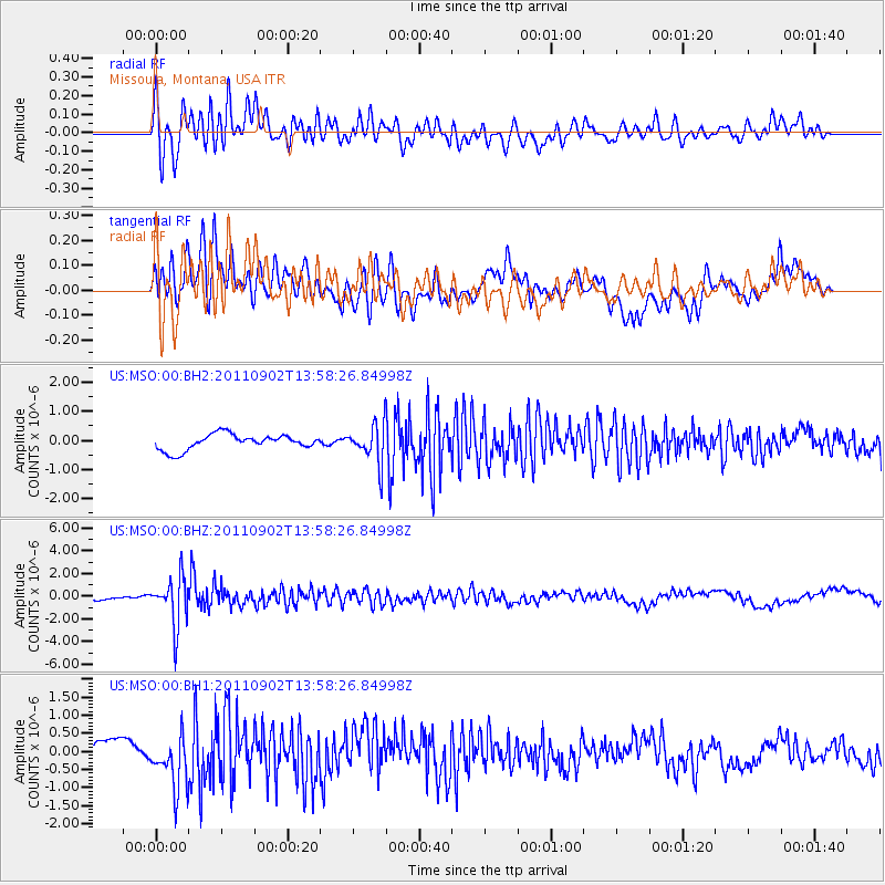
MSO Missoula, Montana, USA - Earthquake Result Viewer
*The percent match for this event was below the threshold and hence no stack was calculated.
| Earthquake location: |
Santiago Del Estero Prov., Arg. |
| Earthquake latitude/longitude: |
-28.4/-63.0 |
| Earthquake time(UTC): |
2011/09/02 (245) 13:47:09 GMT |
| Earthquake Depth: |
579 km |
| Earthquake Magnitude: |
6.4 MB, 6.7 MW, 6.7 MW |
| Earthquake Catalog/Contributor: |
WHDF/NEIC |
|
| Network: |
US United States National Seismic Network |
| Station: |
MSO Missoula, Montana, USA |
| Lat/Lon: |
46.83 N/113.94 W |
| Elevation: |
1264 m |
|
| Distance: |
87.9 deg |
| Az: |
327.771 deg |
| Baz: |
136.821 deg |
| Ray Param: |
$rayparam |
*The percent match for this event was below the threshold and hence was not used in the summary stack. |
|
| Radial Match: |
74.88873 % |
| Radial Bump: |
400 |
| Transverse Match: |
54.49263 % |
| Transverse Bump: |
400 |
| SOD ConfigId: |
558545 |
| Insert Time: |
2013-09-19 02:18:16.942 +0000 |
| GWidth: |
2.5 |
| Max Bumps: |
400 |
| Tol: |
0.001 |
|
Signal To Noise
| Channel | StoN | STA | LTA |
| US:MSO:00:BHZ:20110902T13:58:26.84998Z | 9.867347 | 2.1139604E-6 | 2.1423797E-7 |
| US:MSO:00:BH1:20110902T13:58:26.84998Z | 2.8632948 | 7.5301017E-7 | 2.629873E-7 |
| US:MSO:00:BH2:20110902T13:58:26.84998Z | 2.4849248 | 6.566511E-7 | 2.642539E-7 |
| Arrivals |
| Ps | |
| PpPs | |
| PsPs/PpSs | |


