You are here: Home > Network List > CN - Canadian National Seismograph Network Stations List
> Station INK INUVIK, NT, CANADA.ANADA > Earthquake Result Viewer
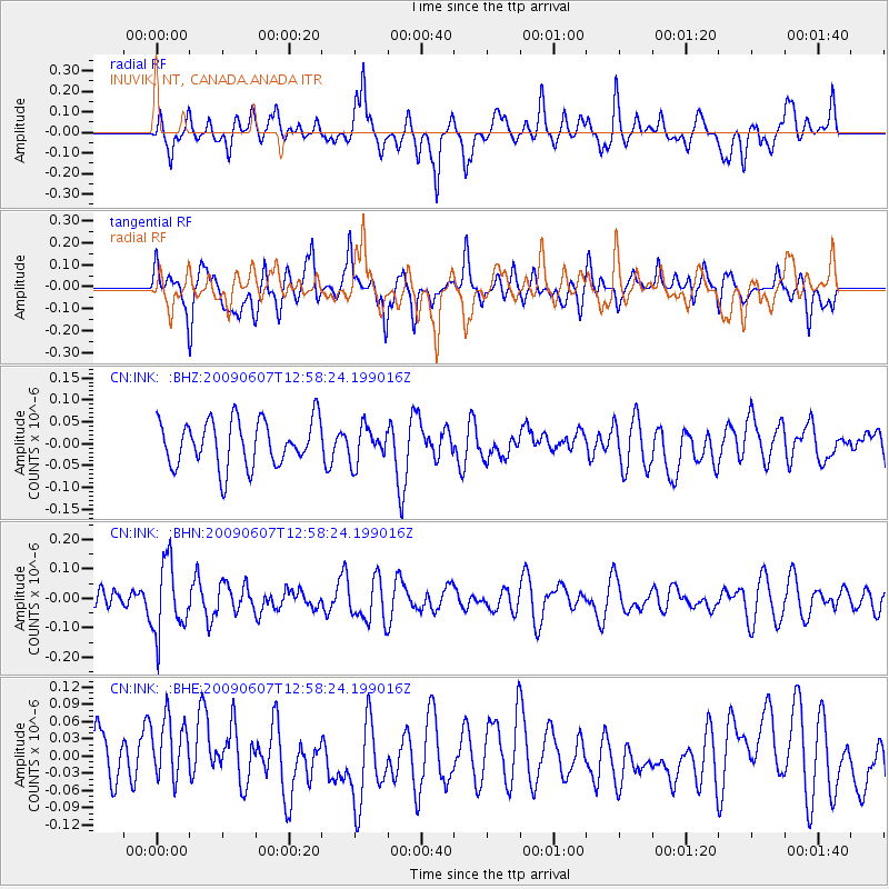
INK INUVIK, NT, CANADA.ANADA - Earthquake Result Viewer
*The percent match for this event was below the threshold and hence no stack was calculated.
| Earthquake location: |
South Of Fiji Islands |
| Earthquake latitude/longitude: |
-22.0/-179.6 |
| Earthquake time(UTC): |
2009/06/07 (158) 12:46:30 GMT |
| Earthquake Depth: |
590 km |
| Earthquake Magnitude: |
5.5 MW, 5.1 MB |
| Earthquake Catalog/Contributor: |
WHDF/NEIC |
|
| Network: |
CN Canadian National Seismograph Network |
| Station: |
INK INUVIK, NT, CANADA.ANADA |
| Lat/Lon: |
68.31 N/133.52 W |
| Elevation: |
40 m |
|
| Distance: |
96.1 deg |
| Az: |
15.621 deg |
| Baz: |
222.22 deg |
| Ray Param: |
$rayparam |
*The percent match for this event was below the threshold and hence was not used in the summary stack. |
|
| Radial Match: |
57.372616 % |
| Radial Bump: |
400 |
| Transverse Match: |
50.60969 % |
| Transverse Bump: |
400 |
| SOD ConfigId: |
2648 |
| Insert Time: |
2010-02-27 06:22:43.703 +0000 |
| GWidth: |
2.5 |
| Max Bumps: |
400 |
| Tol: |
0.001 |
|
Signal To Noise
| Channel | StoN | STA | LTA |
| CN:INK: :BHN:20090607T12:58:24.199016Z | 2.607601 | 1.1970998E-7 | 4.5908095E-8 |
| CN:INK: :BHE:20090607T12:58:24.199016Z | 1.0428843 | 5.6979903E-8 | 5.463684E-8 |
| CN:INK: :BHZ:20090607T12:58:24.199016Z | 0.7592047 | 3.977321E-8 | 5.238799E-8 |
| Arrivals |
| Ps | |
| PpPs | |
| PsPs/PpSs | |


